I was excited to read about a few new features which have been added to Google Earth 7.1
You need to download / update your version of Google Earth to the latest one first.
You will then be able to do several things:
1. Add, or view the SUN - use the SUN icon on the top toolbar, or go to VIEW and tick SUN
2. While you're on the VIEW bar, put a tick next to WATER SURFACE
3. Go to OPTIONS (or view Preferences if you're on a Mac) and tick the new option: PHOTOREALISTIC ATMOSPHERE RENDERING.
This is a BETA option and may not work perfectly for you....
You can now bring the sun down over the water, and with a little tinkering can bring it so that it sets over the water...
Here's a quick go I just had: the sun setting over Loch Slapin, with the Cuillins of the Isle of Skye in the distance...
What can you come up with ?
Here's the Google Earth blog post where I read about the technique first...
A project originally funded by the Royal Geographical Society (with IBG) with an Innovative Geography Teaching Grant to develop teaching ideas for using Google Earth in the Geography classroom, expanded to include ArcGIS Online in 2014
Wednesday, April 24, 2013
Google Earth 7.1
We're now up to Google Earth 7.1, which was released on Monday the 22nd of April, 2013
Get it here.
Check out the new STARRY SKY feature as described on the Google Earth Blog.
There's also mention of a new motion controller....
I've still got my old SpaceNavigator joystick... must hunt out the drivers...
Get it here.
Check out the new STARRY SKY feature as described on the Google Earth Blog.
There's also mention of a new motion controller....
I've still got my old SpaceNavigator joystick... must hunt out the drivers...
Tuesday, April 23, 2013
Digimap for Schools MapStream - WMS for Google Earth
At the start of the year I finished off a project with EDINA, who operate the Digimap for Schools MapStream service, in association with the Ordnance Survey.
This is a little like the Digimap for Schools tool, but without the tools...
Subscribers to MapStream will find that they have access to the Ordnance Survey's mapping at the same scale as Digimap, but the difference is that they stream them into their own GIS software using a WMS (web mapping service) - this works with open-source options such as Quantum GIS, but also ArcGIS and even Google Earth (I was amazed when I first saw this in action...)
One advantage of this option is that the maps are streamed to your GIS as an extra layer, so there is no data storage / installation issue. Having said that, you need a reliable and fairly fast internet connection if you want the maps of course. The cost is much cheaper than Digimap, but you need to use the tools in your GIS client, rather than the ones provided by Digimap. This may require extra time on training how to use your chosen GIS package.
 If you head over to the site, you will now find that there are the first of what will be a series of educational materials for teachers, available for free download. These are particularly designed for subscribers to the MapStream service.
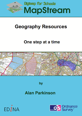
I wrote the materials, the cover of one is pictured to the right....
Check them out.
Subscription is just £35 a year for a primary school and £50 for a secondary school.
I will be referring to this, as well as other mapping options in my GA CPD days which will take place in Birmingham at the end of May and London at the start of June.
This is a little like the Digimap for Schools tool, but without the tools...
Subscribers to MapStream will find that they have access to the Ordnance Survey's mapping at the same scale as Digimap, but the difference is that they stream them into their own GIS software using a WMS (web mapping service) - this works with open-source options such as Quantum GIS, but also ArcGIS and even Google Earth (I was amazed when I first saw this in action...)
One advantage of this option is that the maps are streamed to your GIS as an extra layer, so there is no data storage / installation issue. Having said that, you need a reliable and fairly fast internet connection if you want the maps of course. The cost is much cheaper than Digimap, but you need to use the tools in your GIS client, rather than the ones provided by Digimap. This may require extra time on training how to use your chosen GIS package.
 If you head over to the site, you will now find that there are the first of what will be a series of educational materials for teachers, available for free download. These are particularly designed for subscribers to the MapStream service.
I wrote the materials, the cover of one is pictured to the right....
Check them out.
Subscription is just £35 a year for a primary school and £50 for a secondary school.
I will be referring to this, as well as other mapping options in my GA CPD days which will take place in Birmingham at the end of May and London at the start of June.
Labels:
Digimap for Schools,
EDINA,
MapStream,
Web Mapping Service
Subscribe to:
Comments (Atom)


