Showing posts with label RGS-IBG. Show all posts

Saturday, April 05, 2025

Young Geographer of the Year Competition

A chance for your students to create an ESRI StoryMap.

It's that time of year again for the launch of the Young Geographer of the Year category. 

This annual competition is run by the Royal Geographical Society.

The Young Geographer of the Year is the Society’s annual competition which recognises the outstanding work of the next generation of geographers. With its age ranges spanning the primary years to A Level, the competition encourages thoughtful and creative answers to the competition’s theme which is set each year.

The Society encourages schools to run their own in-house competition and then send their top 10 entries into the international competition. The Young Geographer competition has been running for over 20 years and every year thousands of children across the world take part.
2025 competition

The theme for the Young Geographer of the Year competition 2025 is:

Understanding islands


Let’s take a closer look at the World’s islands.

It is estimated that our planet contains almost 670,000 islands, of which around 11,000 are permanently inhabited. Islands have a unique geography; their landscapes and coastlines vary massively – some are home to volcanoes; others are barely above sea level. Some are barren, deserts or rocky outcrops, others lush vegetation havens for a range of unique wildlife and plant species. There are islands seen by many as popular holiday destinations, and there are others that are inaccessible or many miles from civilisation. Every island is unique, and every island has its challenges.

The geography of islands is an interesting one. 

Some are threatened by climate change and issues such as sea level rise, and through this are embroiled in the geopolitics of the climate emergency and the mitigation strategies implemented through both international policies and local-level action. The people who live on islands face a range of socio-economic, cultural or historical challenges, from over-use of their towns and cities by tourists, to access to resources, clean water or adequate living conditions. The ‘ownership’ of some islands is contested; some are protected, others are fought over because of their geopolitical or strategic significance. In some places, islands are being created to meet the need for more space to satisfy our growing population. By exploring and understanding islands, including the island we live on, we can unlock a multitude of geographical themes and connections across people, places and environments.

The Society invites you to create a poster (Esri StoryMap or poster for KS5 entrants) to explore islands and highlight the geographical themes, challenges and solutions that connect across both human and physical geography to make islands unique. We are looking for eye catching, creative and informative posters and StoryMaps that delve into the socio-economic, cultural, political and physical aspects of a range of islands, showcasing their features and exploring how islands can be connected through the challenges that they face and the solutions they use to address those challenges. 

Your posters and StoryMaps should think about geographical themes across people, places and environments.


Image: Alan Parkinson, waves on Reynisfjara beach - shared on Flickr

Monday, November 18, 2024

GIS Day - check out the RGS-IBG resources

 GIS Day is this Wednesday.


Wednesday, November 16, 2022

GIS Day Livestream

 From the RGS-IBG this afternoon....


We all know our climate is changing. But how much has it already altered in your lifetime, where you live? What are the impacts of this change going to be on your everyday life; on the trains you catch, the food you eat, and the health hazards you experience? 

This GIS Day join us for a live webinar as we explore the history of the climate crisis, predictions about where we are going, and some of the tools helping to mitigate against the most catastrophic outcomes.

This webinar is aimed at students undertaking NEA fieldwork interested in climate change topics, and teachers looking to enrich their climate change teaching with Met Office data and game-changing GIS technology.

Saturday, August 29, 2015

New resources for QGIS and Census Data

In 2014, the Royal Geographical Society awarded two teachers an Innovative Geography Teaching grant of £1000 to fund the development of new resources, based on the use of Census data.
I was one of those teachers, and worked with Ben Hennig to create a new education section of the LondonMapper website: a new project involving Professor Danny Dorling, which explores London through a series of cartograms using Census data.
My Scheme of Work explores the LondonMapper website and materials, and uses the idea of future urbanists looking back at London to see how it has changed over the years.
It connects with the other unit that I wrote for the RGS called Mapping London.


The second grant was awarded to Paul Turner, who takes over as Head of Geography at Bedales School in September. He worked with Dr Adam Dennett, a lecturer from UCL who works at CASA.
Paul's website and materials can now be viewed here, and he is keen to connect with teachers who want to trial the materials. You can contact Paul via the site.
There are 10 lessons which act as an introduction to QGIS, and the mapping and analysis of Census data.


Sunday, October 09, 2011

200 up...

This is the 200th post on this blog, which isn't a lot compared to the 3000 on Living Geography, but sometimes it's quality not quantity. The blog started back in 2006, and a workshop on Google Earth at the Scottish Association of Geography Teachers conference.
At the time I'd just got an RGS Innovative Geography Teaching award to produce Earth: a Users' Guide. Which turned into this blog.. Over the years since I've continued to make use of Google Earth, and explored creative ways of using it for fieldwork, coursework and story-telling. Tom Barrett and I had an application for a Google grant (not successful on that occasion) and I've also met up with Richard Treves who has similarly made really effective use of Google Earth in higher education.

Even in the last few days, there's been the appearance of this CARBON VISUALS resource which offers some interesting ways of exploring energy efficiency in the city of London and beyond.


And now we have the significant milestone of 1 billion downloads of Google Earth


Lot of news coverage:

"Google Earth is probably one of the most downloaded applications of all time in terms of raw numbers," product manager Peter Birch told AFP.
To provide context, Google Earth and Maps vice president of engineering Brian McClendon pointed out that a billion hours ago humans were living in the Stone Age and that a billion minutes ago the Roman Empire was flourishing.
"We're proud of our one billion milestone, but we're even more amazed at the way people have used Google Earth to explore the world," McClendon said.
"When we founded Keyhole, Inc. back in 2001 we never imagined our geospatial technology would be used by people in so many unexpected ways," he continued.
McClendon was a co-founder of startup Keyhole, which Google bought in 2004 and turned into the free online Earth atlas launched in June of the following year.
The service weaves satellite images and aerial photos into 3D interactive graphics which people can zoom into, starting from space and homing in on buildings or plots of land.
Google Earth stories include that of a professor from the University of Western Australia who used it to discover ancient tombs and geoglyphs without leaving Perth.
Professor David Kennedy scrutinized Google Earth recreations of thousands of square kilometers (miles) in Saudi Arabia and Jordan, discerning clues to the whereabouts of archeological treasures.
Retired English teacher Jerome Burg created Google Lit Trips, which uses Google Earth to let readers follow paths set in famous books such as "The Travels of Marco Polo" and "The Odyssey" by Homer.
Renowned oceanographer Sylvia Earle takes Google Earth users under the seas to rally allies in a quest to stop widespread devastation of marine life.
Conservation group Save the Elephants uses the Internet Age atlas to track and safeguard magnificent pachyderms.
Google Earth has been used to help clear land mines, rebuild earthquake-shattered towns, stop mining operations from blasting off mountain tops, teaching geography to children, or simply see one's home from above.
A US couple living in Ireland even used the online atlas to research an ideal place in Oregon to plant a vineyard.
They didn't see the property in person until it was time to close the deal that led to the founding of their dream winery, Grande Dalles.
"Nobody anticipated all the things people would do with Google Earth," Birch said.
"It's a little hard to know where people are going to take it next," he added. "The more you can raise awareness of how we impact the world, the more there will be a chance for change."

There's also the launch of ONE WORLD MANY STORIES


I'm going to be doing some writing next week for a new Google Earth feature which is due to be launched shortly.
Here's to the next billion downloads...

Saturday, July 04, 2009

Michael Palin and Ben Saunders

Google Earth is a great tool for mapping children's stories...

Noel Jenkins has been developing his Wellington Stories mapping activity...


View Wellington Stories in a larger map

This involves QR codes and also GOOGLE MAPPING.

Earlier this year, Michael Palin was introduced as the new President of the Royal Geographical Society (with the Institute of British Geographers)
There's an interesting article in the Independent newspaper today, which can be read by clicking the link.

A few interesting quotes on what Michael thinks about geography can be found in the article.

"For some reason, geography is not seen as a popular subject in school. It's seen as very unglamorous. Yet when I was at school, I can remember geography offering me the chance to get out and go on field trips and go on walks, and I loved maps, I loved atlases, I loved learning about other countries and places where things were different from our own – and that's all covered by geography."

Good to hear the interest in 'the Boss' too....

Ben Saunders is an Honorary Vice President of the Geographical Association.

Ben Saunders from Ben Saunders on Vimeo.

Follow Ben on Twitter @polarben is his account

A recent tweet by Ben lead me to "The Wilderness of Childhood" by Michael Chabon: an article from the NY Review of Books...

This contains an interesting exploration of the importance of place and exploration in children's lives: a theme that was also picked up in the Michael Palin interview.

All of this fits in completely with many of the projects that are currently underway at the Geographical Association, investigating local area using mapping, GIS and technology. These are certainly "interesting times" for geography.

To finish, a quote from the Michael Chabon article:

"Childhood is a branch of cartography"

Wednesday, November 26, 2008

South Ribble Network

Just been investigating the SOUTH RIBBLE materials on the CGEOG NETWORKING section of GEOGRAPHYTEACHINGTODAY.
Loads of good GOOGLE EARTH materials here....

Tuesday, September 02, 2008

New Google Earth Training

Being offered by the RGS (as included in the latest CGeog newsletter)

Google Earth training

FREE Google Earth training for LEA Maintained schools

Google™ has kindly sponsored 10 courses to be run throughout the UK allowing teachers to attend free training sessions. Who is eligible? Key influencers in geography teaching from LEA maintained schools are invited to attend.

Belfast Monday 3 November 08

Edinburgh Tuesday 11 November 08

Birmingham Tuesday 18 November 08

Newcastle Thursday 20 November 08

Southampton Wednesday 26 November 08

Manchester Date tbc 2009

Exeter Date tbc 2009

Glasgow Date tbc 2009

London (RGS-IBG) Date tbc 2009

Cardiff Date tbc 2009

Free of charge - but please note that if you accept a place on one of these courses and subsequently do not attend you will be charged the full price of a standard course. Booking form available at http://www.rgs.org/WhatsOn/Training+and+CPD/Fieldwork+and+expeditions/Google+Earth+training+for+teachers+and+educators.htm

FREE Advanced Google Earth training for LEA Maintained Schools and all CGeogs

The RGS-IBG Chartered Geographer (Teacher) scheme, funded by DCSF, has sponsored courses to be run throughout the UK to allow teachers to attend free training sessions. Who is eligible? Key influencers in geography teaching from LEA maintained schools are invited to attend along with Chartered Geographer (Teachers) from both Independent and maintained schools.

Birmingham Wednesday 19 November 2008

Newcastle Friday 21 November 2008

Southampton Thursday 27 November 2008

Free of charge - but please note that if you accept a place on one of these courses and subsequently do not attend you will be charged the full price of a standard course. Booking form available at http://www.rgs.org/WhatsOn/Training+and+CPD/Fieldwork+and+expeditions/Google+Earth+training+for+teachers+and+educators.htm or email c.wheeler@rgs.org for details

Google Earth Training for Teachers and Educators, Tuesday 21 October 08, London

Coordinated by Jamie Buchanan-Dunlop, Digital Explorer

A hands-on workshop that demonstrates how GPS and digital cameras can be used to capture geo-referenced data on a field trip and used to create classroom resources using Google Earth.

Cost: £141 incl VAT includes notes, lunch and refreshments. Details: T 020 7591 3030 E go@rgs.org W www.rgs.org/GOseminars

Advanced Google Earth Training for Teachers and Educators, Wednesday 22 October 08, London

Coordinated by Jamie Buchanan-Dunlop, Digital Explorer

A hands-on workshop that demonstrates how to integrate field data into Google Earth, creating geo-referenced graphs as well as choropleth maps that can be used in the classroom.

Cost: £141 incl VAT, free to Chartered Geographer (Teachers). Includes notes, lunch and refreshments.

Details: T 020 7591 3030 E go@rgs.org W www.rgs.org/GOseminars


Wednesday, May 14, 2008

New Job and Digital Explorer course...

It's official, so I can tell everyone now...
This was me at the Advanced Google Earth day put on by Jamie Buchanan Dunlop at the RGS-IBG yesterday. Thanks to Yvonne, my partner for the day ...

Any idea what's going on here ? Answer to come shortly...

Here's another clue....

Saturday, May 10, 2008

Off to the RGS

Anyone else going to Jamie Buchanan Dunlop's session on Tuesday of next week ?

This course is designed for people who have already attended the introduction course or are regular advanced users of Google Earth. It will cover how to integrate field data into Google Earth, creating geo-referenced graphs as well as choropleth maps that can be used in the classroom.

The weather looks like being nice for it...
I'll report back after the event.

Friday, August 24, 2007

Free RGS-IBG training

With the generous support of Google™ the RGS-IBG in conjunction with Digital Explorer will be running 10 free of charge Google Earth workshops for LEA-maintained school geography teachers.

These practical workshops show teachers how to create virtual fieldwork using Google Earth. They involve hands-on experience with digital cameras and GPS units creating mini-fieldwork projects outdoors. Participants are then shown how this data can be transformed into a virtual journey using Google Earth.

The workshops will take place across the UK at the following venues:

RGS-IBG, London – Tuesday 16 October 2007
Swansea – Monday 12 November 2007
Newcastle – Monday 19 November 2007
Edinburgh – Tuesday 20 November 2007
Belfast – Monday 10 December 2007
Leeds – Monday 14 January 2008
Birmingham – Monday 28 January 2008
RGS-IBG, London – Tuesday 4 March 2008
Cornwall – date to be confirmed
Southampton – date to be confirmed

Further details of these courses and open courses available for non-LEA school teachers can be found on our website www.rgs.org/GOseminars

If you have any questions please call Lucy on: 020 7591 3030 or email: L.bruzzone@rgs.org

Training is being carried out by Jamie Buchanan Dunlop of Digital Explorer
http://digexplorer.wordpress.com/

Sunday, April 22, 2007

Chartered Geographer

Chartered Geographer

Want professional recognition for all that you do for the Geography community and for Geography within your current school ?
Why not apply for Chartered Geographer (Teacher) status from the RGS-IBG.

I applied this year, and in April heard that I have been accepted, so I am now a Fellow of the Royal Geographical Society and a Chartered Geographer. If you would like to know more about the process, or what I did for my application please get in touch.

I also have a very nice framed shiny 'halo' for my wall...

Saturday, January 06, 2007

Google Earth INSET Courses

Want some INSET on Google Earth ?

The RGS-IBG are offering a full day course looking at using Google Earth to create a Virtual fieldtrip by adding digital content. It's on the 22nd of January, and further details are available on the RGS website. School members should also have been sent flyers. The course is being run by Jamie Buchanan Dunlop and will involve fieldwork in Hyde Park. It costs a very reasonable £30.

Noel Jenkins is also running a course in London on June the 28th. Details are already posted on DIGITAL GEOGRAPHY.

There are also some useful tips at the GE LESSONS website.

Saturday, November 04, 2006

Google Earth Users Guide Project

This project was funded by the Royal Geographical Society (with IBG) using an Innovative Geography Teaching Grant.
It was given funding in November 2005, and work has continued through the following 12 months. The next section of the blog below features the 100+ slides which made up the 2 x 50 minute presentations which I delivered at the University of Dundee in October 2006 as part of the Scottish Association of Geography Teachers Conference.
Enjoy the slides. I will add annotations to most of them.
Other people who were at the conference have also posted materials online, notably OLLIE BRAY and Rob Chambers, who was unfortunately unable to attend owing to serious illness while in Kenya. See the weblinks down the right hand side of the weblog.
Enjoy the presentation, and note that there is now an even newer version of Google Earth than the one I mentioned at the weekend, which features the ability to add lines and polygons to images, which was previously a feature only found in Google Earth Plus.

SAGT Presentation Slides 5-8


It's important for me to publicise the support given by RGS-IBG. It was also good to see Judith Mansell, the Education officer present at the conference too, although Parcelforce managed to lose all her materials (twice!)


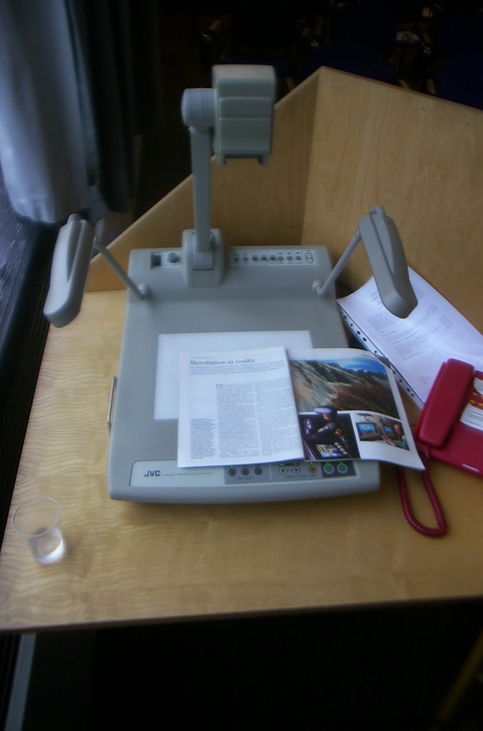
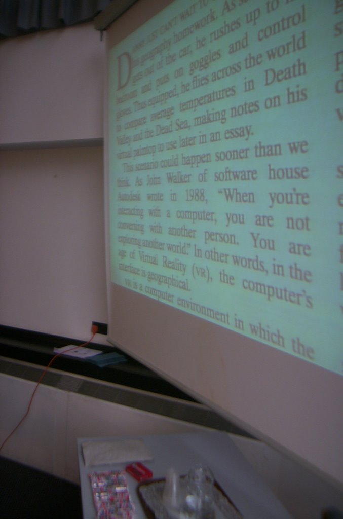
I held up a copy of the Geographical Magazine from 1994. Except, I discovered that one of the tools that I had access to in the lecture room was a visualiser. Worked well the first time anyway. Recommended purchase for the department I think...
The article refers to someone called Danny, who "can't wait to do his geography homework" because he is able to explore a virtual world...

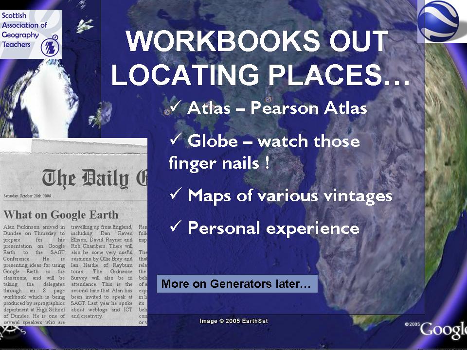
The Workbooks referred to are available to download by going to GEOGRAPHYPAGES. They are available in Word and PDF format.
Plenty of Generators to add interest are available at the GENERATOR BLOG.


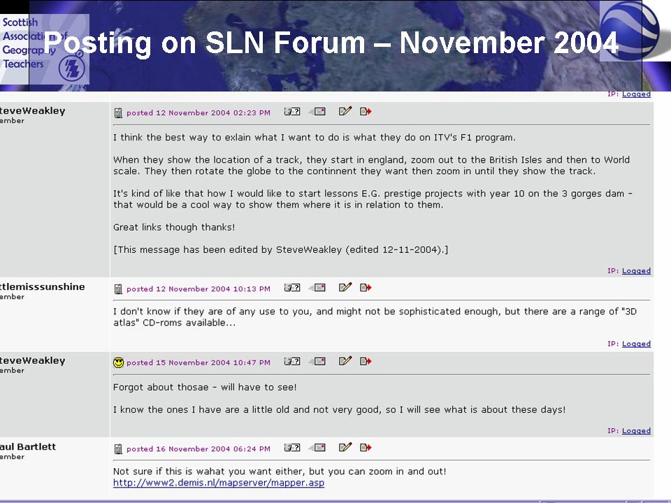
This is a posting on the SLN forum from 2004, where someone wanted to do something which then became possible once Google Earth launched. The SLN forum has plenty of threads relating to Google Earth which have developed over the last 18 months.