Tuesday, December 16, 2014

ArcGIS Online 3D Scene Viewer

As part of the recent December update to the software, ArcGIS Online now has a range of new features, which are summarised here.

One of them is the addition of catchment area calculations, and also downstream channel plots.. Tried this out for a local river and it worked well...

Also extra options for how maps are formatted for embedding on pages, and a new dark canvas basemap, which I like...
Here's a trial map of London

It's interesting timing given the withdrawal of the Google Earth API that one of the most interesting additions is the 3D Scene Viewer option.

Head here to find out more about it... one of my holiday plans is to get stuck into that and see what's possible...


Thursday, December 11, 2014

ArcGIS Online

A new update to ArcGIS Online has been released, and the details are here.
Some very interesting new features described here.

Here's a 3D resource, for example which shows Volcanoes and Earthquakes.
Looking forward to getting stuck in to this...

Wednesday, December 03, 2014

Proud...

Remember to get your certificate if you took part in the event....

Sunday, November 23, 2014

Thought for the Day

Gotta keep it simple
Sending out a signal
Everyday is brutal
Now we're being watched by Google
Being watched by Google
Kasabian - 'Eez-eh'

Thursday, October 23, 2014

Open Supermarket Data

Tracking twitter while having a writing day, and in came a tweet about some new data on supermarket locations, at the GeoLytix blog.
This hasn't previously been available as open data rather than commercially provided.

I downloaded it as an XLS and then converted it to CSV and split it into the different supermarket chains so that it can be viewed in ArcGIS Online - locations were using Postcodes for the time being, although other location options are available.
Here's the location of ALDI stories....

And here's a heatmap showing where ASDA stores are found in parts of the north of England...


Plenty of possible options now for exploring this data and looking at retail locations, demographics etc. plus supermarket location activities.

Thanks to @Geolytix for sharing the data

Saturday, October 04, 2014

The Age of Megacities

Another rather fine ESRI StoryMap
I like the inset map feature top left...


Sunday, September 14, 2014

Better quality imagery in Google Maps

A Telegraph article describes a new satellite which is providing imagery and this will soon begin to improve the imagery in Google products...

Simpsons intro to StoryMaps

A nice use of StoryMaps to explore Springfield...


Thursday, September 04, 2014

Geology in Google Earth

More Geology related mapping, this time in Google Earth, via the Google Earth blog.

They are from the MyReading Mapped website, and feature US based examples..

The addition of features such as eskers makes this a useful resource for those studying Glaciation / Fluvioglaciation / Periglaciation at 'A' level...

ArcGIS Online course at Preston Montford

Those who want an introduction to ArcGIS Online should check out this course, being run by the FSC.
DETAILS HERE


Tuesday, August 12, 2014

New RSGS project now live - complete with StoryMaps

In 1844, Hugh Miller: a geologist and preacher (amongst many other skills and abilities) embarked on a voyage through some of the islands of the Hebrides. 

He was a self-taught geologist, writer and editor of a key Edinburgh newspaper in the lead up to the tectonic changes in the Scottish church that culminated in the Disruption of 1843. Miller was one of Scotland’s outstanding geologists, one of the first of many Scottish ‘citizen scientists’ and stands beside the greats of Hutton, Lyell and Murchison.
The Cruise of the Betsey took place the year after the Disruption, when 450 ministers broke away from the Established Church. Miller joined his boyhood friend the Rev Swanson, a keen supporter of the Disruption, who had been removed from his Small Isles parish and his manse on Eigg. Swanson used the Betsey as his ‘floating manse’ so that he was still able to serve his parishioners. The cruise was to visit Tobermory, Eigg, Rum, Glenelg and Isle Ornsay on Skye. Miller’s accounts record much about the social circumstances they came across as well as detailed descriptions of the geology, palaeontology and landscapes encountered. During the Cruise of the Betsey, Miller made many ground-breaking scientific discoveries. He wrote about his journey on the Betsey, and other travels through Scotland.
I've been working with colleagues from the Royal Scottish Geographical Society on a website and other elements to accompany a range of teaching materials which will be developed and piloted through the next few months, and the website to support the journey has just gone live.


Here's the background to the project:

Follow our journey, and celebrate the life and achievements of a great Scot, a great scientist and a remarkable observer of the social history of the time. Hugh Miller, of Cromarty, recorded his voyage of discovery on the Betsey, around the Inner Hebrides, in the summer of 1844. Our journey will recreate this 170 years later with a crew of geologists, writers, musicians, geographers and other talented people. Join us on our journey!
6th – 12th September 2014

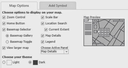
I was invited along on the voyage, but will be teaching at the time. I'm going to be involved in other ways. One of them is to produce mapping, such as the Story Map below:

  and the map of the voyage:
View larger map

Plenty more to come once the 'Leader' casts off...

Friday, July 25, 2014

Get lost....


"With every additional technology that assists in exploring the physical world around us, we are losing our sense of direction and ability to navigate without them."

A good piece by Curtis Silver on mapping and how digital tools and apps might be leading us to lose some of our instinctive navigational skills, particularly for younger generations who perhaps never grew up handling paper maps in the same way as older generations.
It's an interesting geographical / spatial take on the idea of digital natives / immigrants.
It quotes John Kennedy who says that learning to read a map to follow a journey is important in developing a range of elements which are also important to the development of our brains and the way they work:
  • Shape recognition: critical to forming thoughts
  • Direction and orientation: relate to our ability to orient ourselves and the intrinsic ability to know when we are moving away or toward something, (some feel this is critical to moral decision making as well).
  • Analysis and Synthesis: analysis of environmental factors, distance, timing, safety and synthesis, which is pulling these together for seeking a relevant or most appropriate/safe path.
  • Working memory: as we learn to navigate our environment and pull in all the other factors (mental connections) our memory builds until we can find our way automatically (it becomes a zombie system) allowing us the ability to enjoy the environment instead of looking at a screen.
There are some interesting ideas relating to how students would cope if they found themselves somewhere quite close to where they lived, but then had to find their way home. Would they know which way to go ? What are the dangers of relying on technology ?
Gave me some ideas for how this might fit into a landscape unit.
Well worth reading...

Monday, July 21, 2014

Serious GIS

A great new site from Garry Simmons, who has really taken ArcGIS and explored what it can do in the Geography classroom. He's also shared what he can do in a number of places, but now has the Serious GIS website, where materials will be appearing over the year ahead.

You may wish to read about a regional CPD day in October that Garry is organising with Jason Sawle of ESRI. Details here (PDF download) 


At £25 for the day that looks like a bit of a bargain !!

Journey to the Centre of Google Earth...

Via @olimould on Twitter, a link to an article by Simon Sellars (@ballardian ) on Google Earth.

The article also links to a range of Google Earth projects.

Clement Valla's Postcards from Google Earth

The Nine Eyes of Google Street View

Some interesting points made about the nature of Google Earth, and some implications of the capturing of places at moments in time...

Sunday, July 20, 2014

Learn ArcGIS

A brand new site for ESRI ArcGIS products.
Looks great - and has ideas and information for those wanting to develop their GIS skills.

Don't forget to get the ArcGIS Explorer App too if you have a Mac with the latest OS X version....


Thursday, July 17, 2014

Crime statistics

For those of you who might be using the POLICE.UK website to explore crime statistics, here's a useful interactive from the Office for National Statistics.

Sunday, July 06, 2014

New ArcGIS Online features

A load of new features have been released for use by those who subscribe to (or use) ArcGIS Online.
Check out the summary here on the ArcGIS Blog.

The first of these is the ArcGIS StoryMap Journal App, which I shall write a separate blog post to describe. This is one of my (many) summer holiday projects.


Check the ArcGIS Blog for the details on the new release for July.


There's a LIVING ATLAS OF THE WORLD web app.

There's also the USGS Historical Topographic Map Explorer 

The ESRI Collector App is also improved.
Check this Joseph Kerski video which shows how he used it to collect data in the field on a smartphone.


There's also a new Explorer app for iPad

Add in a range of new analysis tools and other bits and there's plenty to get excited about....
If only I had a long holiday ahead to get to grips with it all...

New QGIS resources - available to trial - feedback welcome

A few months ago, I had a conversation with Charlotte Graves, who is developing some teaching materials and approaches for QGIS (a free Open-source GIS package)

The materials are now available to use and trial. Details are available HERE.

There is a questionnaire connected to the trial, which will help Charlotte to create further materials, and those which are of as much relevance as possible. This was part of her research, as she explains here:

The aim of my research was to create a plugin for QGIS that would encourage and support the use of GIS in schools at minimum cost and with as much ease as possible.

I am now in the final stages of my dissertation and the QGISforSchools plugin is ready for testing. 

It takes the form of a QGIS plugin that provides 3 units (on Population & Development, Tourism and Earthquakes) that provides a student (or teacher) who is new to GIS with a step-by-step introduction to the software. The intention is that the software is simply used to explore the Geographical topic, rather than to teach the user how to use the software on his/her own.

I would be very grateful if you could spare some time to test the plugin and provide some feedback for my dissertation, and to inform the future development of the plugin.

The steps for testing the plugin can be found at the link above.

Charlotte has also provided a useful list of suggested resources for those who want to explore GIS in more detail.

Monday, June 23, 2014

DataShine

DataShine is another opportunity to access data from the Census 2011.
There are some good opportunities for filtering and displaying the data in various ways.


Thanks to Oliver O'Brien for the lead to DATASHINE. This map below, for example, focusses on properties that are usually empty.
This is Windermere in the Lake District, and the red colour tells you that the houses are mostly empty, which means that they are second properties. What impact does this have on those communities ?
Which other areas have lots of red properties ?

This would fit nicely with the enquiry in Chapter 10 of my book 'Fieldwork through Enquiry'.


You could also use it to create mystery type questions. E.g. which religion is shown in red in these cities ?


Use the tool or your knowledge of the Midlands to find out the answer...

Thursday, June 19, 2014

FieldTrip GB


One of the questions that I had at the recent courses was on the use of fieldtrip apps.
I've had the app on my phone for a while but hadn't explored it, but was prompted to take another look by the question, but also by the work that I saw from Sevenoaks and other schools, who were starting to use it.

The app itself is created by EDINA, who have also created Digimap for Schools.
I wrote the Secondary teaching materials to go alongside the Digimap for Schools platform, and also for their MapStream service (OS maps streamed into a GIS client like QGIS) and am about to start work on the

There is a DESKTOP site to go alongside the app, which can be used to create DATA CAPTURE FORMS. These can be used on the site to capture data at specific points, which can then be exported in KML or CSV format.

I've been experimenting with this, and there are still a few areas I need to explore further to ensure that it works for me....
Here's a form I created for a trip to Sevenoaks tomorrow...


Sustainable Fish map

Another map built on ESRI's StoryMap template for ArcGIS Online (a summer project)

A Danish map providing advice on selecting and identifying sustainable fish species in various sea areas.

Wednesday, June 18, 2014

Doddle GIS resource

Free resource from Doddle (a Boardworks link)
ICT, GIS and Fieldwork...
Would make a good starting point for discussions - a nice sample...


'Feels like' temperature maps for the UK


View Larger Map

Another map which was shared in the last few days, created by the ESRI UK Education Team

UPDATE
Now a live humidity map too...

ArcGIS Online map of Terrestrial eco-regions...


View Larger Map

One of several new maps that I came across today .... Keep checking back for more new maps as I come across them...

Saturday, June 07, 2014

The course that wasn't...

I have an embarrassing day on Thursday when running one of the final Google Earth and Beyond courses for the GA.
The internet at the venue didn't work for the first hour and a quarter of the day, and then came and went during the day, so the course was 'cancelled' but we hung on and I ran through a condensed version of events... less time for ArcGIS Online in the afternoon, which is a pity.
Apologies once again to those who made the journey to London, and thanks to the delegates who hung on and persevered with the day for your kind feedback.

Thanks also to Catrin, who sent through one of the outcomes that she had produced following the course, based on Snowdonia, and with a series of tasks and questions with layers to turn on and off... Really nice work.


Friday, June 06, 2014

ESRI Ed Community - ArcLessons

ArcLessons is a community for users of ArcGIS Online who share their lessons.
Although not all of the lessons are based on Geography, there are some ideas which you could adapt to Geography..
Some great contributions from Joseph Kerski, and also from Bob Lang.
For delegates at the GA course, I shall be putting some of these resources in the Dropbox area...

Sunday, June 01, 2014

Graeme Eyre - 2009 vintage...

Still some interesting ideas to pick out of this... Things have moved on in the five years since Graeme produced it, so the final bits have now been sorted anyway with other mapping tools, but nice ideas to adapt...


Friday, May 30, 2014

Google Treks..

Visit some amazing places via Google Treks.


Keep scrolling down on the various pages to uncover some great imagery....

Google says 'Hello World'....

They said it a while ago...

Wednesday, May 28, 2014

Tour de France

Some ideas from Fred Martin for using the Tour de France as a context for teaching GIS.


A good place to start further exploring....

Monday, May 26, 2014

Eurovision Story Map

Here's another example of what ArcGIS Online is capable of creating with a little effort.
A map to show the various winners of Eurovision over the years...

Follow @EsriStoryMaps to find out the latest maps as they are highlighted...

Sunday, May 25, 2014

Imperial Airways to Cape Town...

Reminded of this earlier, as an example of using Google Earth to tell a story - not necessarily GIS work, but has great potential as a framework for other journeys and investigations.
Lovely work by Richard Allaway from his Geography all the Way site.


Virtual tours of the Gaywood River valley

If you're after a tour with a hydrological / ecosystems services focus, check out these tours made for a rivers project close to where I live in Norfolk, created by UEA.

Dr Amii Darnell, Professor Andrew Lovett and Dr Jenni Turner have created three ‘virtual tours’ that can be viewed in the free Google Earth software and which provide an introduction to the key environmental features of the Gaywood Valley east of King’s Lynn in Norfolk. The tours have been created as part of the Sustainable Urban Fringes (SURF) initiative which brings together partners from five European countries in a number of projects to enhance the value of nearby rural areas for urban communities (www.sustainablefringes.eu). In the case of King’s Lynn one objective was to encourage local people to explore the valley and find out more about its history and wildlife.  The virtual tours have been produced to provide background information in an easily accessible form and to highlight sites that can be visited. Teaching materials are also being developed so that the tours can be used in local schools.The tours were constructed as sets of text, photos and map information that can be opened in Google Earth, provide instructions to guide the viewer to different landscape features and then display additional information about them (including links to websites). Each tour has a different theme, the first supplying a general introduction to the area, the second focusing on geology and past climates, and the third including details of possible walks and sites to visit.

New ArcGIS background map of London

If you follow THIS LINK you'll be taken to an alternative map background for your maps which is an OS map of 1890s London.
You can zoom down to a high resolution and compare with the imagery of the city, and then build a map on top of the vintage mapping.
Thanks to Jason Sawle for the tipoff to this new opportunity for historic mapping.

Here's the area around Mary Ward House near Euston for example...

SketchUp Warehouse

Ready for the Google Earth and Beyond Course in London in June.
There are over 5000 models that have been made and placed in the SketchUp warehouse with the tag 'London'..... Well worth exploring...

Using Sketch Up Models in Google Earth

Instructions by Noel Jenkins which I used on the recent GA Course on Google Earth and Beyond.
They worked well...
Follow the instructions to grab a model from the SketchUp Warehouse and place it wherever you want on Google Earth...


It's worth saying that you'll need to have SketchUp installed on your computer to do this.

SketchUp Warehouse has undergone a substantial face-lift since the last time I visited last year and now has various new options and a range of new models.

Models can also now be embedded as a preview in 3D
Here's the MARACANA stadium in Rio de Janeiro...

Making Google Earth more realistic...

One of the sections of the Google Earth and Beyond course that I run for the GA currently has a brief look at the OPTIONS (or Preferences on a Mac) that can be accessed from within Google Earth. These affect the user interface and there are some (like the vertical exaggeration of terrain) that are quite useful.
A recently tweeted post on the Google Earth blog, provided a link to a post providing a few tips for making your existence of Google Earth as 'realistic' as possible (although it may require more computing power and slow your computer down a little)
One of these relates to the atmosphere which can be made more photo-realistic and therefore allow you to sink the sun down over the sea....

Story Maps

A project for the summer is to get to grips with Story Maps on ArcGIS Online, which seem to be getting more straightforward to set up.
Here's one of Lord of the Rings filming locations for example.

Or the TWISTER dashboard...

There are lots of examples, and APPS that can be used to create the story....

OS Open Space and OS Maps in Google Earth

OS Open Space is a project which allows access to some Ordnance Survey mapping.
There's a Google Earth layer within OS Open Space apparently.

I normally direct people to Gavin Brock's OS Layer.

Tour de France routes

Starting in Leeds on the 4th of July is the world's greatest sporting event: the Tour de France.
You can download various KML files for the route from a number of places.

Map my Ride have created some kilometre by kilometre versions, and there are also some nice video tours of the route that can be accessed, such as the one below.

Similar tours can be created using Google Earth...

New maps and data for ArcGIS Online


Check the maps and galleries here.

Click the LESSON IDEAS tab and provide an e-mail and school name to get access to some guidance documents.
And don't forget the day long dedicated ArcGIS Online course at ESRI's Aylesbury HQ

Wednesday, May 21, 2014

Where are the Google Street View cars driving ?

Recognise this - have you ever seen one ?
I've seen them twice - once near Sutton Bridge in Lincolnshire, and once in Lowestoft.... I checked the area, but I don't appear in the images...
I'm also waiting for my street to be done again as my house, which is about 5 years old, was in the process of being constructed when the car came down the road...
This website provides some interesting detail on the way that Streetview images are created, the different vehicles that are used, and then a map showing the global coverage.
Click your country to see where the cars are currently driving...

Would be good to spend a day with one of the cars....

New terrestrial biomes layer...

Via Google Earth blog, a useful file showing the earth's terrestrial biomes....

Sunday, May 11, 2014

BRITICE - mapping the British Ice Sheets in Google Earth

BRITICE looks like being really useful for those studying cold environments, and the impact that the British Ice sheet had on the country, and the landforms that it left behind.
It's a project of Chris Clark and colleagues at the University of Sheffield.

There is a range of mapping available, including a Google Earth layer, and also files that can be opened in ArcGIS and other similar GIS packages.

One for those who want to get stuck in to some serious analysis of glacial features.

Thanks to Al Monteith for the tipoff to the site via Twitter.

Saturday, April 26, 2014

Historic Street View

Google is adding a historical imagery slider to Street View, so that you can see how the street has changed during the time that the imagery has been taken. This will vary in use depending on where you live, or which streets you look at, but might be interesting for charting retail change etc.

Saturday, March 29, 2014

Want to talk Google Earth... or something else...

I'll be here during the Geographical Association conference.


Thursday, March 13, 2014

Google Maps Gallery

Google Maps Gallery has just been released, and it provides a lot to interest Google Earth users too.
This post on the Google Earth blog provides more details.

The aim of the gallery is to "help unlock the world's maps".

ArcGIS Online Video

There will be a range of videos added here and some further content relating to ArcGIS Online, as I am using it in conjunction with Google Earth and other tools to explore locations...

)

Wednesday, March 05, 2014

The slow demise of Google Earth... (?)

I've always called Google Earth the 'killer app for geography teachers'. I've used it every week since it first came out.

Its tremendous visual appeal, coupled with the uses that the community made of it, with additional layers and files meant that it very quickly became the best way to start a lesson with a visual 'wow' impact. This has lessened over time, and it's remarkable how many students still haven't seen their house on it, but it remains a really valuable (and free) tool.

Within a month of the launch, I'd been in touch with the Education Officer at Google at the time, and he was kind enough to let me have a version of Google Earth Pro for a year.

Google Earth offers virtually seamless access to huge amounts of data. For more information on just how great Google Earth is, I recommend reading the final chapter of Jerry Brotton's book 'A History of the World in Twelve Maps'
Over the last few years, a lot of the emphasis for Google has been on their Mapping, and several of the features that might have been developed for Google Earth have instead been diverted to the mapping option.
There was a recent post on the Google Earth Blog by its creator Frank Taylor, which suggested that support for Google Earth might be reducing.
This was also picked up in a post by Richard Treves, who has also made impressive use of Google Earth with university students.
He asked: 'Will educators miss Google Earth' ?
Maybe the next post, on Google Map Gallery will redress some of the balance ?


There's also been a recent update to Frank's original post

Thursday, February 27, 2014

Exploring London - Google Earth may feature...

Delighted to say that I've been awarded one of just two of these awards handed out this year, given out by the Royal Geographical Society, to work on a collaboration jointly with Dr. Benjamin Hennig from the University of Oxford on a project related to the Census of 2011.

Ben is the genius who created the Worldmapper cartograms, and creates maps at Views of the World.
He is now working at one of the finest Geography departments in the world, and it is a real privilege to get the chance to work with him.
Our project is called LondonMapper: exploring a World city through Census Data

The Census 2011 produced billions of pieces of data, and by focussing on London past, present and future we will explore ideas related to London and its place in the world, and guide students on an exploration through the Census data and present them with some decisions that need to be made, which will shape London's future...

Our work will connect with, and expand on the nascent LondonMapper project.

Look out for more new maps like this one


Some more interesting London-based news coming in the next month or so too....

Thursday, February 13, 2014

2014 Winter Olympics

Details here of some Google Earth models and other mapping linked with the current Winter Olympics.

Google Earth Time Zones

A useful resource which is one of several shared by Ted MacKinnon on his website.

Sunday, January 26, 2014

Richard Treves' tutorials...

I mentioned Richard's work on the recent Google Earth and Beyond course...

Here's a link to the first video from Richard's course, from which you can probably find the others.
Useful additional material.

Saharan Memorial story...

This story has been in and out of various websites for a while, and I've always meant to do something with it, but never had the time...
I don't have the time now, so this won't be a fully fledged resource just yet, but some readers may be unaware of the story.
Start by heading to Google Earth and type the following co-ordinates (or cut and paste them from here) into the address search box on Google Earth.

16°51′53.748″N 11°57′13.362″E

Now go and read the story on the BBC website.

How would you use the story as ISM (initial stimulus material) for a lesson ?
Which topic would it support ?

Google Earth Function Sheet

How many of these do you know ?

Saturday, January 25, 2014

SAMR

The SAMR model is a way of thinking about your use of Technology in the classroom.
It starts with Substitution: i.e. just doing what you would have done anyway, but with technology, then moves through Augmentation and Modification to reach Redefinition.
What does Google Earth allow you to do that would not be possible without it, in an educational context ?
Here's a sheet that you could use to help capture your thoughts and/or discussions.
Aim high...

Friday, January 24, 2014

Wembley way...

I showed the delegates the possibility of adding models from SketchUp into Google Earth.

The SketchUp 3D Warehouse has a range of models, and I showed the WEMBLEY model as an example of what can be added...

ArcGIS Online

Thanks to all those who came along to the GA Google Earth and Beyond course at the Leicester Mercure on Thursday this week.
I demonstrated ArcGIS Online along with Google Earth on the GA course. This is available in free and subscription versions for schools. I am going to be sharing more ideas for this over the next year or so.
Just used ArcGIS to map the POLICE.UK crime figures...
Plot an area around your school.
Go to DETAILED STATISTICS and download the CSV file.
Drag into ArcGIS ONLINE to visualise it instantly....


Sunday, January 19, 2014

Some favourite GE resources

I asked my Twitter network to suggest resources for Google Earth that should really be added to the course because of recent additions or developments.

Thanks to the following folks, for the following suggestions:

Keir Clarke suggested Climate Viewer 3D, which makes use of the Google Earth plug in. Has a range of information in addition to climate data, created in a series of layers...


Limestone Landscapes

A useful model for how to put together a piece of work on Richard Allaway's Geography all the Way site. This particular resource is free access, but others are part of the subscription site, which is well worth subscribing to.


There are several Limestone Landscapes included in the original resource, with a particular focus on a walk through the Yorkshire Dales around the classic Malham round.
Download a Google Earth file with some images and a sheet to go with the walk....

Scribble Maps - online and mobile applications...

This tool has improved since I first came across it some years ago - very nice easy shape creation and area measurement automatically done.
Check out the SCRIBBLE MAPS website for the links through, or download the application to a mobile device.


Google Earth Tour Builder

This was recommended by several people.
This video was made by Richard Treves - search the blog for more of his work...

Head to the Google Earth Tour Builder website to get started.

XKCD on mapping