A project originally funded by the Royal Geographical Society (with IBG) with an Innovative Geography Teaching Grant to develop teaching ideas for using Google Earth in the Geography classroom, expanded to include ArcGIS Online in 2014
Sunday, May 29, 2016
Saturday, May 07, 2016
Early bird still open for Practical Pedagogies 2016
I was due to present at the first running of this event last year, but was unable to go as it clashed with my trip to Iceland, and return to full-time teaching, so had to pull out.
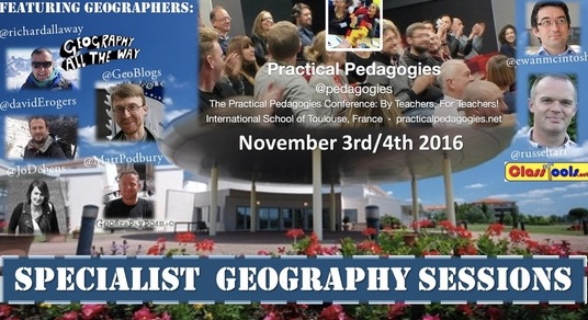
Russel Tarr has pulled together another excellent programme of events which will take place in the first week of November, and this time I can make it. In fact I'm already booked for my flights, and my colleague Claire is coming along too, which is a bonus!
Just got to sort my accommodation now.
I will be presenting at Practical Pedagogies 2016.
EARLY BIRD BOOKINGS ARE NOW AVAILABLE
The full programme is HERE.
My session is called 'The Power of Geographical Information', and is described below:
Matt Podbury has shared some of the other Geography names who will be presenting at the event over on his fine GeographyPods site.
See you there?
Russel Tarr has pulled together another excellent programme of events which will take place in the first week of November, and this time I can make it. In fact I'm already booked for my flights, and my colleague Claire is coming along too, which is a bonus!
Just got to sort my accommodation now.
I will be presenting at Practical Pedagogies 2016.
EARLY BIRD BOOKINGS ARE NOW AVAILABLE
The full programme is HERE.
My session is called 'The Power of Geographical Information', and is described below:
The Power of
‘Where’: Geographical Information in the curriculum
Geography is an academically robust subject which spans the social and
physical sciences and promotes a lifelong interest and fascination in how the
world works.
Nicholas Crane, President of
the Royal Geographical Society
Abstract
Geographers are interested in spatial
patterns, and the growing availability of, often real-time, location based information
brings new depth to teaching geography. Students don’t only consume this
information, but they also produce it themselves, and it is also used after
natural disasters to aid the relief effort.
The workshop will explore how this renewed
focus on the ‘where’ can bring new ideas to teach familiar topics, but also
broaden these activities into other curriculum areas. It will include ideas
from several ERASMUS-funded projects, a resource on transport geographies, a
project for the British Red Cross and work completed in the classroom by
pupils.
So there'll be plenty on digital mapping and its use in the classroom.
So there'll be plenty on digital mapping and its use in the classroom.
You’ll leave the session with some
practical pedagogical resources to adopt and adapt, and ideas for personal
innovation, as well as introducing some free tools and mobile apps.
Matt Podbury has shared some of the other Geography names who will be presenting at the event over on his fine GeographyPods site.
See you there?
Thursday, May 05, 2016
New updated Mapstream page
A few years ago now, I wrote a whole suite of lessons for Edina's MapStream for Schools service. For those who don't know what this is, it's a streaming service for the Ordnance Survey's mapping. Unlike Digimap for Schools, which has a set of tools that come with it, this provides a stream of the maps themselves, which can then be visualised by another GIS tool, such as QGIS.
Check out the updated website… and the resources… and MapStream….
Labels:
Digimap for Schools,
EDINA,
MapStream,
Resources
Subscribe to:
Comments (Atom)


