Thursday, November 04, 2021

GeogLive! Maps and Mapping

The fifth GeogLive! event takes place on the 17th of November.


More details here.

You can book a FREE ticket (and see YouTube recordings of previous events) on this link.

Maps are essential in geography. Many simple activities can help pupils develop skills in making, reading and using maps. Want to know more?

About this event

Two part session on Maps, mapping and atlases.

Part 1: Dr Stephen Scoffham : Atlases in the classroom

Part 2: Case Study: Maps in practice: Three Y5 classes collaborate using three different scales of study to explain a sense of human, physical and environmental space and place.

Chaired by Julia Tanner @EYPPC_GA committee, @The_GA

This free webinar will support conversations about maps, mapping and atlas use in the EY and Primary classroom. The chat will be open and will feature lots of inspiring ideas to support what is being said to support your teaching.

This webinar will conclude with a Q+A and some information about the extensive support the Geographical Association offers: high-quality classroom resources, inspirational teaching ideas, Subject Leader guidance, excellent continuing professional development events, and stimulating networking opportunities, reflecting OFSTED’s recent recommendation that teachers draw on "subject-specific support and professional networks ‘ (Ofsted, 2021).

Find out more:

https://www.geography.org.uk/Free-Primary-Membership

https://www.geography.org.uk/Journals/Primary-Geography

Sunday, October 31, 2021

Popbuilder

Thanks to Brendan Conway for the tipoff to this site, which provides population estimates and structure for specific small areas in the UK.


Popbulder is a web-app
that lets you build a population estimate for a set of small areas in Great Britain. The estimates are for the population in mid-2020.

1. The boundaries appear automatically when the map is zoomed in.

2. Click or tap the areas of interest: the estimated population is shown in the top right.

3. Click or tap “Get data” to see the age-distribution.

4. Turn the boundaries on and off manually using the boundary control in the bottom right.

Created by Oli Hawkins.
Here's the pyramid for my particular part of mid-Norfolk - as you can see it's quite a top heavy population distribution.


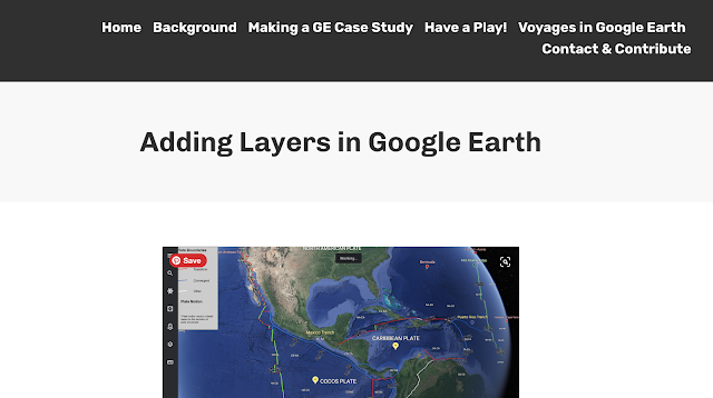
Adding layers into Google Earth

Seems like this is back again: Andy Funnell has shared some ideas.


Tuesday, October 19, 2021

Climate Change - Teach with GIS

The new ESRI UK Education Team resources for teaching about the Climate Emergency have now been released and are ready for use. They explore climate change in the UK, and were produced in partnership with the Met Office.


They include Teaching Resources for different key stages including Primary.

They also include a Teacher Knowledge section.
This includes the useful resource on COP26 below.
A typically stylish and useful set of resources generously shared.


Friday, October 15, 2021

The Human Reach Atlas

This is a collection of ESRI StoryMaps which has been published ahead of World GIS Day.

It's called the Human Reach Atlas.

Wednesday, October 13, 2021

La Palma Eruption StoryMap Collection


Excellent work by Alistair Hamill and others, which has been shared by Jason Sawle and the ESRI team.

Friday, May 21, 2021

Geofolio

Thanks to Geofolio for an opportunity to explore your area and generate loads of information automatically.

As it says on the website:

Define an area of interest anywhere in the world, and we'll automagically create thematic factsheets containing interactive maps, charts, written overviews, and statistical summaries – all based on open geodata.


I had a play of course. I went to North Norfolk, where colleagues took part in 2 days of coastal fieldwork earlier in the week. What would the site tell me about this location?


Here's the report that was generated... 

It was a tipoff via Richard Allaway.

This has great potential for generating secondary data about locations.

Thursday, May 20, 2021

A raindrop's journey to the sea

This is a rather fine map tool / experiment / visualisation.

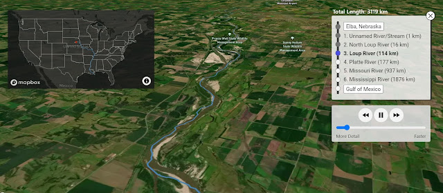
It is called River Runner, and will allow you to follow the route taken by a rainfrop. 

Make your raindrop fall anywhere within the contiguous United States and the website will work out the route it will take to the sea and the tributaries and rivers it will flow through. It will then take you along that route.

It's really rather good visually, and I am assume is also accurate.


Check out Sam Learner's other map projects.

Friday, April 02, 2021

Thanks Jason

A well deserved step up for Jason, who I have known for quite a while now, and who has always been helpful and supportive... we ran joint courses for a while about 10 years ago when I was working for the GA. Follow Jason on Twitter to see where he goes next....

ESRI's tools have come a long way, and are now free for most and increasingly powerful and flexible.

500 up

A small milestone perhaps, compared to the 10 000+ posts over on LivingGeography, but passed 500 posts on this blog, which has actually been around for quite a while, in fact predating LivingGeography. The blog began as part of a project funded by the Royal Geographical Society's Innovative Geography Teaching grants - I've received quite a few of them over the years.

It has broadened beyond Google Earth to take in Digimap for Schools and then ESRI's ArcGIS Online and StoryMaps.

Meanwhile Google Earth has changed, moving to the PRO download, which is still my preferred format, and now the Chrome browser version with its Projects builder option....


Friday, March 05, 2021

National Trust Climate Change Threat Map

This has appeared today and been mentioned on the BBC News site.

It's created using ArcGIS mapping from ESRI.

Visit the map here. A web app.

National Trust director for land and nature Harry Bowell said: "This map is a game-changer in how we face the threat climate change poses to the places we care for.

"While the data draws on a worst-case scenario, the map paints a stark picture of what we have to prepare for. But by acting now, and working with nature, we can adapt to many of these risks."

The charity says staff are already taking action to cope with rising temperatures:

Heat-tolerant plants are being grown at Ham House in London, which the map warns could often face 40C (104F) heat by 2040
At Lyme Park in Cheshire, which was hit by a major flood in 2019, trees are being planted on moorland to slow the flow of water and reduce flooding risks
At Mount Stewart in County Down, where rising sea levels have contributed to coastal erosion, a shelter against incoming water has been made
At Malham Tarn, in the Yorkshire Dales, where a 18th-Century barn collapsed due to soil shrinkage, teams will plant trees and use specific plants to manage the water table

The map plots the impacts of extreme heat and humidity, landslides, coastal erosion, shrinking and shifting ground due to wet and dry conditions known as "soil heave", and high winds, in 2020 and 2060.
Take a look and see how your own home area fares.

Wednesday, March 03, 2021

Thought for the Day

“A map is the greatest of all epic poems. Its lines and colors show the realization of great dreams.” Gilbert H. Grosvenor

Thursday, February 25, 2021

A map which shows a terrible toll...

Hardly any part of the country has remained untouched by the pandemic...

The latest interactive map from the ONS.


Sunday, February 21, 2021

Rivers and GIS crowdsourcing project

Time to sign up for the Great British and Irish River Managment GIS Initiative, being organised by Alistair Hamill, Brendan Conway and Andy Funnell.

As it says on the sign-up page:

The local walk has been the lifeline for so many of us over the past year. The chance to get away from the desk and from the computer screen; the chance to get out and feel the wind against your back and the warmth of the sunlight on your face (or, perhaps, if you live in N. Ireland, yet more rain driving into your face!)

And, perhaps, during your local walks you have come to know your local area a bit more. Perhaps you’ve ventured down pathways or streets you don’t normally walk; perhaps you’ve come to appreciate that little bit more that place we call our community.

Maybe, like me, you’ve spent more time exploring your local river, getting to know all its twists and turns, watching it respond to the changing weather patterns. Perhaps you have come to appreciate it even more too.

If so, then the Great British & Irish River Management GIS Initiative might be just for you.

The idea behind this is to pool the resources of geography teachers and other interested parties in a kind of ‘citizen science’ data capture of river management across these islands. Not in some theoretical way – but in the way it happens on the river beside us, the river we have local knowledge and experience of. River management as it actually happens, warts and all. So we’re interested in the small scale stretch of river beside you; the kilometre or three that you walk along, that you know and love well.

We will use GIS to collect and collate the information. All it will take is for you to collect data with your phone and you will be supported into how to bring this into the wonderful world of GIS. Don’t worry if you haven’t much experience in using GIS so far. The skills you will need for this are very accessible and you will be supported in developing them.

Townscaper

Townscaper 1

I first came across this game in July 2020 when it was on early access on Steam, and sadly not available for iOS. I coveted it. It's created by Oscar Stålberg.

I downloaded it a couple of months ago, and have finally had a few hours to get to play with it, and it's excellent and very calming.


I shall probably be posting numerous screenshots in different locations over the next few days.

There's a GUIDE here, although you can start playing immediately by choosing a colour, scrolling around the existing town and then clicking in different directions. I love watching the seagulls circling and settling on the rooves as well.

Here's the description on Steam. It currently costs £4.79

Build quaint island towns with curvy streets. Build small hamlets, soaring cathedrals, canal networks, or sky cities on stilts. Block by block.

No goal. No real gameplay. Just plenty of building and plenty of beauty. That's it.

Townscaper is an experimental passion project. More of a toy than a game. Pick colors from the palette, plop down colored blocks of house on the irregular grid, and watch Townscaper's underlying algorithm automatically turn those blocks into cute little houses, arches, stairways, bridges and lush backyards, depending on their configuration.
Post settings Labels Urban,Townscaper,Games Based Learning,Games,Cities, No matching suggestions Published on 19/02/2021 12:38 Permalink Location Options Post: Edit

Saturday, February 13, 2021

StreetView in a Pandemic

Thanks to Rob Morris for forwarding this article on the use of Google Street View to 'take us places' when we are unable to visit places at the current time, and international travel is looking unlikely for another summer. 


Google Street View
may offer us a short-term escape as we perhaps explore (un)familiar places which are far away...

The New Yorker piece has some interesting ideas which would be relevant to the classroom. One person who is mentioned is Nick Nicholaou, a London-based developer, who built a site called MapCrunch ten years ago. 

I've used this for about that long in sessions with teachers and also in my teaching, and it allows for random street views, or views within a particular country or area chosen on the map. It also mentions games / challenges such as the MapCrunch Airport Game.

Sunday, January 24, 2021

GA Conference Teachmeet 2021


Once again, we are not able to be in person at a GA Conference, so aspects of the conference cannot be done face to face. There are many highlights of any GA conference, and the Teachmeet has become established as one of them: taking place at the end of the first full day and a chance to extend the day and have a beer with friends while listening to ten or more colleagues sharing ideas from their classrooms.


You can sign up to either present or lurk here.

To get a flavour for the atmosphere at a Teachmeet, you can still watch 2019's version here. Thanks to Rich Allaway of Geography all the Way for live streaming the event.

This year, we are particularly interested in new and diverse voices and storytellers, who have never presented before and are ready to step up and share an idea. There should also be a link to the conference theme of Compassionate Geographies.

Tuesday, January 19, 2021

RIP MTJ

 I heard earlier today about the passing of Michael T Jones via Ed Parson's Twitter feed.

He was one of the people behind the development of Keyhole, which later became Google Earth.

For over 15 years, this tool has helped to revolutionise our geography teaching and also the way we, and students conceptualise the earth.

"We are going to make discovering the Earth a joy - like you're dating a planet and you want to know it, to hear all about its past and hopes. That's what we did: we made something immersive and engaging and personal. You can fly to your home--fly to your parents' home - and remember the time you snuck out in the backyard and did something you shouldn't do, or the place where you had a first kiss, or the place you got married."

This article from 2013 outlines some of his thinking, as downloads passed one billion.

Monday, January 04, 2021

New ESRI School Atlas Collection


Shared by the ESRI UK Education Team.
A new collection of digital atlases for use in lockdown learning.

Don't forget that the GA also has its Geography From Home section ready to help as many return to remote teaching for a few weeks at least.