Friday, May 21, 2021

Geofolio

Thanks to Geofolio for an opportunity to explore your area and generate loads of information automatically.

As it says on the website:

Define an area of interest anywhere in the world, and we'll automagically create thematic factsheets containing interactive maps, charts, written overviews, and statistical summaries – all based on open geodata.


I had a play of course. I went to North Norfolk, where colleagues took part in 2 days of coastal fieldwork earlier in the week. What would the site tell me about this location?


Here's the report that was generated... 

It was a tipoff via Richard Allaway.

This has great potential for generating secondary data about locations.

Thursday, May 20, 2021

A raindrop's journey to the sea

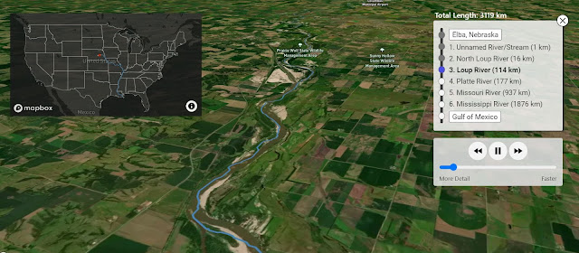
This is a rather fine map tool / experiment / visualisation.

It is called River Runner, and will allow you to follow the route taken by a rainfrop. 

Make your raindrop fall anywhere within the contiguous United States and the website will work out the route it will take to the sea and the tributaries and rivers it will flow through. It will then take you along that route.

It's really rather good visually, and I am assume is also accurate.


Check out Sam Learner's other map projects.