Why not share your ideas, and move towards being a COLLABORATOR rather than an ISOLATOR.
Thanks to Quentin d'Souza for allowing use of his image below. Which one most describes your practice and what can you do to move to the left ?

 This will come in useful for us, as we take our 6th formers to Cambridge for a Human field day, and this will make our Virtual walk through even more lifelike. We use Google Earth for fieldtrip briefings.
 Students are asked to find an image which looks particularly impressive artistically, perhaps like the one above, and save it - by screenshotting, or otherwise..
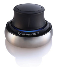 Enjoying my Space Navigator - it's responsive and I'm getting the hang of the various axes of movement that are available. I love the ability to zoom right into details on images as well, which works very well on the IWB. Get one for Christmas! You can order one from 3D Connexion, delivery is very prompt.
 Discovered this place today while flying around Google Earth with my Space Navigator.
Google Earth just been used by Sky News to zoom in to the location of a breaking news story.

