The site is already 'live', with some fun games and other content but don't forget that nothing much will be happening Santa-wise before Christmas Eve....
Friday, December 20, 2013
Merry Christmas and a Google Earth New Year
As with the last few years, you can follow Santa's journey on Christmas Eve via the Google SantaTracker tool.
The site is already 'live', with some fun games and other content but don't forget that nothing much will be happening Santa-wise before Christmas Eve....

The site is already 'live', with some fun games and other content but don't forget that nothing much will be happening Santa-wise before Christmas Eve....
Monday, December 16, 2013
What does winter mean to you ?
That's a key question posed by the Pole of Cold team who are currently heading for Oymyakon, the coldest inhabited place in the world, to explore how communities cope with extreme cold. I've been thinking about this in the last few days, as we move towards Christmas which (when I was a lad) would guarantee freezing temperatures and plentiful snow....
We will be looking at the team's journey as part of the new materials I'm creating for the Google Earth courses that are definitely going to take place early in the New Year.
What's the coldest you've ever been, and where were you at the time ?
Please tweet me a reply to @GeoBlogs, or add a blog comment below. Thanks to those folks who have already replied in the few minutes since I tweeted the original question...
While we're on the subject of winter, have some free Mission:Explore missions which are all primed and ready should we get a white Christmas, which is looking quite unlikely judging by the shirt-sleeve weather we currently have in Norfolk...
Sunday, December 01, 2013
GA Google Earth Courses
Good news earlier this week that it seems the remaining GA Google Earth courses are likely to be running in 2014. The first is in January in Leicester.
One of my jobs over Christmas will be to refresh those courses, and add in any new findings since the last time they ran.
I also need to refresh my memory of ArcGIS Online and how to use this tool in the classroom...
Look forward to seeing some of you there...
One of my jobs over Christmas will be to refresh those courses, and add in any new findings since the last time they ran.
I also need to refresh my memory of ArcGIS Online and how to use this tool in the classroom...
Look forward to seeing some of you there...
Thursday, October 31, 2013
Tivy Education Medal
The Tivy medal is not awarded every year, and is awarded for outstanding contributions to Geography and education.
Previous winners that I could find were:
2008 - Jim Carson
2009 - Erica Caldwell
2010 - Anita Ganeri
2011 - Scottish Association of Geography Teachers
At the recent Scottish Association of Geography Teachers' Conference, Mike Robinson - the Chief Executive of the Royal Scottish Geographical Society read out a citation describing the person judged to have been worthy of being presented with the medal this year, and it turns out it was me!
It was presented by Professor Iain Stewart, who is the President of the Society.
Along with the medal, there was a very nice certificate of honorary fellowship.

What was equally important to me was to read and hear the comments of others who were there, who appreciated the work that I've created, and shared over the years....

Thursday, October 17, 2013
GA course postponed...
Apologies for those hoping to meet up with me in a month or so in London for the first of the year's Google Earth and Free GIS courses. The first course has not recruited enough delegates to go ahead, so will be cancelled - more dates available later in the year - the other dates that are available are included on this poster here:

See you in Leicester in January perhaps ?
See you in Leicester in January perhaps ?
Thursday, September 19, 2013
New from Richard Treves...
Google Earth for Teachers resources.
As featured on GEarth Blog.http://www.gearthblog.com/blog/archives/2013/09/great-google-earth-resources-teachers.html
Go HERE to find introductory page to the online login.
Click ENTER AS GUEST and browse away...
The Checklist document is a useful one for those who want to develop their skills in a particular way, or create perhaps a Google Earth course, with certificate, for students to follow in their own time (or as part of prep or homework tasks...)
Check the YOUTUBE channel too...
Another really useful Google Earth link, and a useful reminder of some of the recent changes and updates.
Also read this to see how Google Earth has changed...
New sky diving game
Thanks to Keir Clarke for the link to the game.
You'll need to use CHROME to play it...
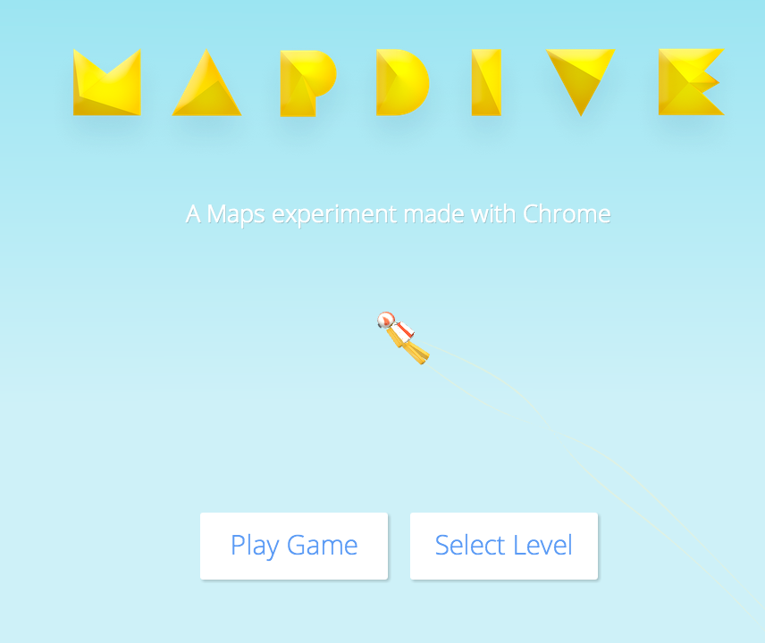
Sky dive onto famous landmarks, and steer between checkpoints and catch stars for points....
Give it a go...
You'll need to use CHROME to play it...
Sky dive onto famous landmarks, and steer between checkpoints and catch stars for points....
Give it a go...
Saturday, September 14, 2013
Enhancing Fieldwork Learning Showcase
Last year, I went to the 2nd annual Showcase event of the project at Preston Montford Field Studies centre, and until recently I was due to attend the 3rd event at Rhyd Y Creuau
I gave a presentation last time on our work with Mission:Explore and the connections with ludic pedagogies...
This time I was going to talk about the DISTANCE project that we have been working on.
However, instead of making my way to Snowdonia yesterday, I was teaching, and instead of presenting at the FSC Centre today, I was marking Year 7 homework. All part of my transition back to teaching...
I've tweeted a few folks who are at the event, and from the sound of it there have been some excellent presentations and fieldwork excursions.
I've been following the event hashtag too: #eflshowcase
Follow the Twitter account too...
Some apps and other tools that I've been using for some years have been getting a mention, so good to know that I'm up to date here... Some further new ideas too. Some of the resources will also be shared on the website after the event hopefully...
A mention of GE Graph on here...
Wednesday, August 14, 2013
GA Google Earth and beyond course...
The details of the CPD courses being offered by the GA in the new academic year have been released, and are available for booking now.
Visit the website for details of all the courses.
I'm delighted to say that I will be leading the following days... at various venues around the country from the middle of November through to June 2014...
Hope to see some of you at one of these events...


Visit the website for details of all the courses.
I'm delighted to say that I will be leading the following days... at various venues around the country from the middle of November through to June 2014...
Hope to see some of you at one of these events...
Friday, August 09, 2013
News on the 3D Warehouse
I picked up this news earlier today via the Google Earth blog.
I've made good use of the 3D Warehouse and SketchUp for some years now... It's at least 6 years since I first started playing with SketchUp and this blog also features some awesome work by Noel Jenkins who has used it with his GCSE groups.
Here's the announcement:
It may be worth downloading some of the models that you think you will make use of now before they potentially disappear, or get harder to find and access.
I've made good use of the 3D Warehouse and SketchUp for some years now... It's at least 6 years since I first started playing with SketchUp and this blog also features some awesome work by Noel Jenkins who has used it with his GCSE groups.
Here's the announcement:
“Hi folks,
With the goal to have every building in the world accurately displayed in 3D, we’ve explored different methods for modeling large areas of our planet in 3D, including technologies like SketchUp, Building Maker and lately 3D Imagery. We’ve decided that in order to pursue the most consistent user experience, we’ll be focusing our resources on the technology that will scale to the entire world and will be discontinuing support of the user generated 3D program.
We’d like to thank all of you who helped form the landscape of Google Earth and helped cities around the globe grow out of the 2D realm, and into the imaginations of virtual 3D explorers everywhere.
Models can still be uploaded to the Trimble 3D Warehouse, where they can continue to be shared with the modeling community, but they will no longer be published to Google Earth starting October 1st, 2013. Existing models will remain visible in Google Earth, until a time when they’re replaced by new models generated for that region. Google Takeout lets you download an archive containing all of your models.
On a personal note: I’ve had the good fortune of being involved in the 3D modeling effort for Google Earth from the beginning, and I’ve watched many of you create collections of amazingly detailed architectural wonders from every corner of the Earth. I’m very thankful to have been along for that ride and to have gotten to know many of you over the years.
With respect and appreciation,
- CraigD and the 3D Modeling Team”
Now it seems that there are changes to the way that 3D models created by people will be accessed.It may be worth downloading some of the models that you think you will make use of now before they potentially disappear, or get harder to find and access.
Thursday, August 01, 2013
For Sale: one slightly used web domain
In 2001, I created a website called 'Mr. P's Geography Pages' which was hosted on the free TRIPOD service.
A few years later, I moved it to web hosts 123Connect and it became 'GeographyPages'.
At the time, other than David Rayner's GeoInteractive and David Robinson's site there were very few Geography-specific websites. This was in the days of Netscape Navigator and dial-up modems chirruping away...

The site had a few thousand visitors a year, but quickly grew to over a million visitors and well over that in terms of page views.
I had to double the bandwidth, and then again and again....
The website still gets hundreds of thousands of visitors a year, although I 'archived' it in 2008 when I joined the Geographical Association.
If anyone is interested, the domain name is for sale.... one slightly shop-soiled URL
(Not that I anticipate anyone will be for a moment....)
The site will be disappearing shortly, so grab your favourite bits while you can.
The end of an era...
And the start of another in a month's time....
Saturday, July 27, 2013
Sail the Book
Contacted by Ira Bickoff from Hudson Valley, New York, with a link to a project that has been put together linking story telling about the Oceans and Google Earth.
Check out the work, which is nicely put together, and could be adapted for other authors and place contexts.
A number of books have been included, such as Darwin's Voyage of the Beagle.

Check out the work, which is nicely put together, and could be adapted for other authors and place contexts.
A number of books have been included, such as Darwin's Voyage of the Beagle.

Friday, July 26, 2013
Resources by Richard Treves
A useful Prezi, shared at recent event in Southampton, and also a link to a MOOC on Google Earth tools.
Saturday, July 06, 2013
QGIS - free course - take Google Earth a step further...
I've been running courses for the GA on 'Google Earth and Beyond' for some time now.... the beyond bit means moving towards Free GIS....
 QGIS or QuantumGIS is open source software.
I used it to create the teaching materials for EDINA's MapStream service.
As a GIS package, this is capable of carrying out most of the same tasks as a package like ArcGIS.
It is also capable of acting as the host programme to run a WMS (web mapping service)
A WMS which you may be interested in Edina's MapStream - I have blogged about it previously (and recently) because of my involvement in creating the teaching resources.
While blogging this I remembered, and hunted out a set of resources for use with QGIS, which I got in 2008ish.
They were produced by the British Antarctic Survey, and provided a range of activities for exploring the South Pole and surrounding areas. They came in a spiral bound folder complete with various paper maps of the continent. I shall see where I might be able to fit some of those into my teaching.
 For anyone who really wants to get to grips with QGIS, there is also a third option now.
A new set of materials created by Ian Allen @LearnPracGIS can be accessed HERE.
You can sign up for a free course. A Quantum GIS for Newbies eCourse.
Follow the link on the right hand side of Ian's page.
And keep an eye out for the GA's schedule of courses for the new academic year. They involve reruns of the various courses that I'm running including the Google Earth and beyond course....

I used it to create the teaching materials for EDINA's MapStream service.
As a GIS package, this is capable of carrying out most of the same tasks as a package like ArcGIS.
It is also capable of acting as the host programme to run a WMS (web mapping service)
A WMS which you may be interested in Edina's MapStream - I have blogged about it previously (and recently) because of my involvement in creating the teaching resources.
While blogging this I remembered, and hunted out a set of resources for use with QGIS, which I got in 2008ish.
They were produced by the British Antarctic Survey, and provided a range of activities for exploring the South Pole and surrounding areas. They came in a spiral bound folder complete with various paper maps of the continent. I shall see where I might be able to fit some of those into my teaching.

A new set of materials created by Ian Allen @LearnPracGIS can be accessed HERE.
You can sign up for a free course. A Quantum GIS for Newbies eCourse.
Follow the link on the right hand side of Ian's page.
And keep an eye out for the GA's schedule of courses for the new academic year. They involve reruns of the various courses that I'm running including the Google Earth and beyond course....
Tuesday, June 25, 2013
GPS2Google Earth for Android
A useful looking app for displaying the places that you have visited on Google Earth.
Free on Google Play

Via the Spatial in Schools ScoopIt page, which has lots of other useful links...
Free on Google Play

Via the Spatial in Schools ScoopIt page, which has lots of other useful links...
Monday, June 24, 2013
Burj Khalifa
A brand new STREET VIEW gallery of the tallest building in the world.
And an explanation of how it was created..
And an explanation of how it was created..
Stourbridge models...
Just had occasion to visit Stourbridge in the West Midlands on Google Earth... it's a long story... and someone has been busy creating lots of models in the area....
Enable 3D buildings to see them...

Enable 3D buildings to see them...

Friday, June 21, 2013
Another simple idea for GE - this time from Tony Cassidy...
Uses the Google Earth overlay showing the Earth at night today when introducing North and South Korea http://t.co/l8jM5cEwv0
— tonycassidy (@tonycassidy) June 21, 2013
Google Earth A-Z
One idea for enabling student investigation of the functions and tools that Google Earth has to offer, as well as the areas that can be explored using the tool, why not challenge students to put together a Google Earth A-Z
P is easily covered with Paths, Placemarks, Polygons etc to cover, or perhaps you want to do it thematically by looking at Google Earth resources on the Oceans for O, or Volcanoes for V
I've created a Template in Comic Life, which could be used as the basis for a colourful display in a room where Google Earth is used...
See it and download it from below:
Google Touring
A useful post from Richard Treves outlining a possible solution to the problem with Google Tours that seems to affect people in version 7

Richard was hoping to join me at my Google Earth course, but unfortunately couldn't make it...
Maybe next time :)
Tuesday, June 18, 2013
River Severn
Quick example of building a lesson idea, based on the River Severn.
Search 'River Severn KML '
Uncovers files for the source of the Severn and the Plynlimon catchment. This is where the river starts, before it heads off on its long journey to the sea.
Go to BBC Learning Zone and find a clip on the River Severn from source to sea or explore the Upper course of the river
Has a helicopter shot over the moors near the source - could recreate that in Google Earth as a tour as one 'challenge'.
Put together a set of shots that the helicopter pilot has to film, and recreate those as tours, or find the locations and add them into Google Spreadsheet Maker 2.0 to create placemarks along the route.
What will students discover about the course of the River Severn ? It starts by heading in the opposite direction to the one that it eventually takes ? Can they discover why it changed direction ?
Students to investigate the way that the landscape changes as they move along the route, or explore examples of the ecosystem services that the river provides.
Identifying river features from the air.
Adding in some other land uses and evidence of how people are using the river. How has the river changed by the time it has passed down to the lower course ?
Use the measurement tool to see how the width has changed over that time.
Drag in the Environment Agency website data to see what the usual and current levels of flow are at various points along the river.
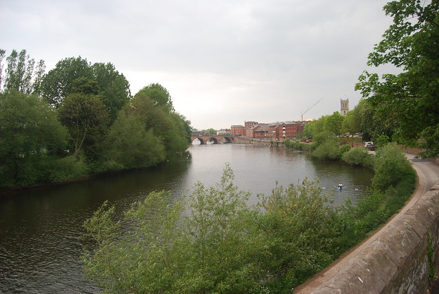
Sourcing CC images - perhaps making use of GeoGraph for these
e.g. this image of the Severn near Ribbesford Woods.
Click to get the location of the image - add in the extra figures of the grid reference.
Use NEARBY to convert to lat long
Can also get a lat long if you know where the location is by switching to Google Maps. Right click on a location and select What's Here, or look bottom right in Google Earth to see it displayed.
Can also save images from searches on Geograph - KML files can be generated of groups of images, or those around an area. These could be saved and form the basis for some investigation.
Carry out a SEARCH on GEOGRAPH and look for the KML link at the bottom of the search returns page.

An overview of the River Severn here.
Look for changes to the course using the NPE MAPs link which shows old maps. Has the route altered as a result of management...
What else could be added here ?
Image: Alan Parkinson
Google Spreadsheet Mapper 2.0
A reminder of this tool which adds some additional assistance to the process of mapping data from spreadsheets.
Part of Google Earth Outreach work.
Open up the special spreadsheet, and save a copy in Google Drive.
You can amend the sample contents to suit your project, and publish the spreadsheet.
This will generate what is called a NETWORK LINK.
This means that any changes to the spreadsheet will result in a different map being generated
And also removes the need to have a spreadsheet package installed on your machine...
A video here:
Monday, June 17, 2013

Wednesday, June 12, 2013
Embed KML gadget
Made a KML file - perhaps a TOUR ?
Now you can embed it on a webpage using the EMBED KML GADGET
I made a new GOOGLE SITE to host my files...
https://sites.google.com and follow the instructions...
Copy the Link Address and paste it in...
Now you can embed it on a webpage using the EMBED KML GADGET
I made a new GOOGLE SITE to host my files...
https://sites.google.com and follow the instructions...
Copy the Link Address and paste it in...
Tuesday, June 11, 2013
Google Earth and Maps course now OPEN
The Google Earth and Maps course that I mentioned a while back has now gone live...
You can participate in courses for both Google Maps and Google Earth.
Go here for more information and to register.
More details on this YouTube video, introduced by Tina Ornduff, who I met at the Dublin Google event last year.
Once you've registered, you'll find out more about the course, which starts on June the 10th....
Why not join me ?
A few other new websites...
A few other Google Earth / Maps related websites which might be of interest...
The first is the Google Earth Engine.
Posted about this before, but a reminder of the environmental elements which can be accessed from the site.
Google Earth Engine brings together the world's satellite imagery — trillions of scientific measurements dating back almost 40 years — and makes it available online with tools for scientists, independent researchers, and nations to mine this massive warehouse of data to detect changes, map trends and quantify differences on the Earth's surface. Applications include: detecting deforestation, classifying land cover, estimating forest biomass and carbon, and mapping the world’s roadless areas.

Also check out the GeoData portal from Tufts University in the USA.
Plenty of layers which can be accessed using the search function, and then adding them to the cart (which enables a download of the data - often in shapefile format)
The shapefiles could presumably then be opened in ArcGIS Online.
There is a user guide which can be accessed by clicking the tab top right....
Thanks to Keir Clarke for the link to the site....
Tuesday, June 04, 2013
Google Earth Balloon Maker
One of the things that most people want to be able to do is change the nature of balloons attached to placemarks so they can add content and format it appropriately.
The Google Earth Balloon Maker from Mr. Macfadden may be the answer for some teachers. It 'automates' the process of creating balloons a little by adding a WYSIWYG (what you see is what you get) style editor...
Watch the video below to see it in action, then try it for yourself...
The Google Earth Balloon Maker from Mr. Macfadden may be the answer for some teachers. It 'automates' the process of creating balloons a little by adding a WYSIWYG (what you see is what you get) style editor...
Watch the video below to see it in action, then try it for yourself...
KML.... not an airline
As I explain on the GA course, files which are created using Google Earth are generally saved in KML format. This is short for Keyhole Markup Language.
If you are particularly keen to find out more, I have a book about KML which provides plenty of information about the language.
What files are available out there ?
Well, to show what can be found, I did a quick Google search on the term 'kml geography' and came up with some interesting files within a couple of minutes:
- a file released by the US Data.gov website showing radiation levels in and around Fukushima.
(follow the link, and use the search button, and there are over 700 files apparently for download on a range of topics) - US based, but plenty on tornadoes, hydrology, hurricanes etc.
- information about files which have been made available by the Office for National Statistics (as well as shapefiles which can open in ArcGIS Online if they have less than 1000 elements to them)
- teach a bit of RE too ? check out these BIBLE files
- wildfires in your spec (Edexcel 'B' for example) - go HERE and click DATA to download KML files for current fires (depending on the season...)
Don't forget the old KML Factbook as well
USGS Earthquake Page

This page of KML resources would be a useful additional resource for students using Google Earth to explore natural hazards.
Friday, May 31, 2013
TIMELAPSE project...

The Time magazine TIMELAPSE project visualises several areas of change: from the growth of Dubai to glacial retreat.
Excellent stuff...
Thursday, May 30, 2013
Let Osprey...
Thanks to Spin the Globe for the lead to a useful resource which uses Google Earth to explore migration and related issues.
It is based on work done to track the Ospreys who live on Rutland Water.
Check out the Google Earth map that tracks them.

Follow on Twitter too: @SpintheGlobe
It is based on work done to track the Ospreys who live on Rutland Water.
Check out the Google Earth map that tracks them.

Follow on Twitter too: @SpintheGlobe
Adding local images into Google Earth placemarks... and IPERNITY
While running a Google Earth course last week in Birmingham, I went through how to add an image to a Placemark. The first issue was that FLICKR has recently changed. This means that it is less straight forward than it used to be
On the plus side
One disadvantage of this is that many schools may find FLICKR and other possible places to store images are blocked in some schools.
There are other alternatives: a blog could be used for examples, although once again these may be blocked in some schools.
A website called IPERNITY now has the option to transfer up to 200Mb of photos per month from FLICKR.
Some browser add ons need to be installed for this process to work...
Once they are installed, it's very easy to add in your photos one chunk at a time... I'm currently doing that so that my photos 'live' in three places. Check my photos HERE.
A bigger problem was that the facility to add local images: from a laptop or other location that wasn't online had stopped working. This would be useful in a school environment where files could be created which will work within the classroom, and not require images to be fetched from an online location.
It was a bit embarrassing that it was no longer working though as I was expecting to show it in action.
I delved into various forums and found quite a few work arounds for adding local images which didn't seem to work very well, but then found one which did....
The first step apparently is to ensure that LOCAL images can be used with Google Earth, which is a setting in the OPTIONS.
This is not checked by default, but I think needs to be ticked for local images to be available for placemarks.
A particular folder path is then required to add to the code that is provided for adding an image: a KML tag which looks like this![]() - which basically points Google Earth to the location where it can find the source of the image.
- which basically points Google Earth to the location where it can find the source of the image.
Instructions follow - added to Slideshare - hope they're helpful...
On the plus side
One disadvantage of this is that many schools may find FLICKR and other possible places to store images are blocked in some schools.
There are other alternatives: a blog could be used for examples, although once again these may be blocked in some schools.
A website called IPERNITY now has the option to transfer up to 200Mb of photos per month from FLICKR.
Some browser add ons need to be installed for this process to work...
Once they are installed, it's very easy to add in your photos one chunk at a time... I'm currently doing that so that my photos 'live' in three places. Check my photos HERE.
A bigger problem was that the facility to add local images: from a laptop or other location that wasn't online had stopped working. This would be useful in a school environment where files could be created which will work within the classroom, and not require images to be fetched from an online location.
It was a bit embarrassing that it was no longer working though as I was expecting to show it in action.
I delved into various forums and found quite a few work arounds for adding local images which didn't seem to work very well, but then found one which did....
The first step apparently is to ensure that LOCAL images can be used with Google Earth, which is a setting in the OPTIONS.
This is not checked by default, but I think needs to be ticked for local images to be available for placemarks.
A particular folder path is then required to add to the code that is provided for adding an image: a KML tag which looks like this
Instructions follow - added to Slideshare - hope they're helpful...
Getting local image files to work in google earth from GeoBlogs
By the way, the next Google Earth course is in London in June, but it's fully booked.
They'll be running again in 2013-14.
Watch the GA website for details as they emerge.
By the way, the next Google Earth course is in London in June, but it's fully booked.
They'll be running again in 2013-14.
Watch the GA website for details as they emerge.
Free ArcGIS Online course
After the Google Earth / Google Maps course I described in the last post, there's now a chance to take part in another course, this time based on ArcGIS Online.
Sign up at COURSERA for the course, which starts in July.
Details here...
The past decade has seen an explosion of new mechanisms for understanding and using location information in widely-accessible technologies. This Geospatial Revolution has resulted in the development of consumer GPS tools, interactive web maps, and location-aware mobile devices. These radical advances are making it possible for people from all walks of life to use, collect, and understand spatial information like never before.
This course brings together core concepts in cartography, geographic information systems, and spatial thinking with real-world examples to provide the fundamentals necessary to engage with Geography beyond the surface-level. We will explore what makes spatial information special, how spatial data is created, how spatial analysis is conducted, and how to design maps so that they’re effective at telling the stories we wish to share. To gain experience using this knowledge, we will work with the latest mapping and analysis software to explore geographic problems.
Wednesday, May 29, 2013
Google Maps and Google Earth course
I've just enrolled to take part in a new free course that is being offered by Google.
Introduction to mapping with Google.
You can participate in courses for both Google Maps and Google Earth.
Go here for more information and to register.
More details on this YouTube video, introduced by Tina Ornduff, who I met at the Dublin Google event last year.
Once you've registered, you'll find out more about the course, which starts on June the 10th....
Why not join me ?

Saturday, May 25, 2013
Google Earth MOOC
An interesting new resource from Richard Treves on his Google Earth Design blog.
A new MOOC (online course) on Google Earth.

A new MOOC (online course) on Google Earth.
Google Maps Mania
In the recent Google Earth course that I ran in Birmingham, I showed Where's the Path.
Thanks to Keir Clarke for pointing out that the site has undergone an update.
Follow this link to see a version that has been updated, and modified so that it can be viewed on tablets.
A useful additional mapping resource to go alongside Google Earth with its new tools.
Thanks to Keir Clarke for pointing out that the site has undergone an update.
Follow this link to see a version that has been updated, and modified so that it can be viewed on tablets.
A useful additional mapping resource to go alongside Google Earth with its new tools.
Wednesday, May 22, 2013
LocateStreet
Uses Google Maps rather than Google Earth, but worth a mention here...
 You may have seen on my earlier post on GeoGuessr the mention for LOCATESTREET
This is a variation on GeoGuessr, with various points being offered for guidance, although the Elevation option doesn't offer that much help...
You can choose to play on a Global basis, or other scales.
You are presented with 4 options of location to choose from, and if you pick the correct option you can earn bonus points for clicking on the actual location on a map...
The site takes you to some fairly out of the way places... I seemed to end up on rural roads, and in cul-de-sacs on industrial estates quite often.
Hardcore players should choose the GLOBAL option... and discover that South America looks a lot like Australia in places...
Choose the COUNTRY option, and explore a range of countries from a list, which includes the UK. This offers potential for a CITY based search for example.
There are also some US based Thematic search options.
The game is addictive. Had to stop myself playing on it last night....
If you get one of the highest scores so far you can enter your e-mail to be added to the High Score table. May be an incentive for some to use additional 'support' to search for business names etc., but that wouldn't be in the spirit of the game...
Also, while playing, I've come across a few random sights.
This looks like some sort of hawk diving into a field to catch something ?

And what is this bloke doing standing in the road ?

 You may have seen on my earlier post on GeoGuessr the mention for LOCATESTREET
 This is a variation on GeoGuessr, with various points being offered for guidance, although the Elevation option doesn't offer that much help...
You can choose to play on a Global basis, or other scales.
You are presented with 4 options of location to choose from, and if you pick the correct option you can earn bonus points for clicking on the actual location on a map...
The site takes you to some fairly out of the way places... I seemed to end up on rural roads, and in cul-de-sacs on industrial estates quite often.
Hardcore players should choose the GLOBAL option... and discover that South America looks a lot like Australia in places...
Choose the COUNTRY option, and explore a range of countries from a list, which includes the UK. This offers potential for a CITY based search for example.
There are also some US based Thematic search options.
The game is addictive. Had to stop myself playing on it last night....
If you get one of the highest scores so far you can enter your e-mail to be added to the High Score table. May be an incentive for some to use additional 'support' to search for business names etc., but that wouldn't be in the spirit of the game...
Also, while playing, I've come across a few random sights.
This looks like some sort of hawk diving into a field to catch something ?

And what is this bloke doing standing in the road ?

The game was developed by Nick Burkhart of Chelonia Labs in California.
As with GeoGuessr, there are various clues that you can look for to help with locating yourself in fairly random housing estates.
Telephone dialling codes tend not to be blurred out. 020 will tell you that you're in London.
If on a main road, head for junctions where there'll be road signs.
Look at the vernacular building materials - some places have distinctive stone or house designs.
Become familiar with the basic geography of London, which features heavily in the UK option.
Be aware though, that they can be misleading. I spotted a Yorkshire registration on a motorbike, which ended up being up in the far north of Scotland, flipping tourists...
Tuesday, May 21, 2013
Google User Community

This used to be called the Google Earth Bulletin Board, but a few months ago it was replaced with a system of Google Groups, one of which is for Google Earth.
Search this for thousands of useful KML files and guidance.
Whatever you're after, it's probably here...
Here's a few examples that I found with a quick five minutes of searching:
- Texas biomes as an image overlay
- Everest reconaissance with routes
What is your best discovery in the Google Earth groups ?
Mapteach

MapTEACH is based in ALASKA and uses some Google Earth materials to help explore certain elements of the area, and tell their story.
The use of maps to help stories is part of the indigenous culture, although they didn't use GIS or Google Earth of course... until recently.
Click the CURRICULUM link to see various GIS data files as well as Google Earth files.
Duncan Maclean from Kindrogan

Some nicely formatted and clear guides to GE, placemarks and importantly GE-Graph.
A few other new bits...
Preparing materials for course for the GA Google Earth and Beyond course on Thursday - just updated the Dropbox that goes with the course, and changing the spine powerpoint now, as well as reminding myself of some nice visualisation tools and other links.
Was putting together a new document on the Historical Slider, and looking for places where the imagery can be used best.
Came across this nice weblink, with 10 interesting places to visit on Google Earth.
Students could do this themselves of course and find ten places they would like to visit... or 10 examples of a particular feature e.g. active volcano...
Also remembered the old BIG HUGE LABS option for Earth as Art... (as shown by Noel Jenkins)

Also check out WHAT WAS THERE....
Monday, May 20, 2013
250 up
250 posts on the blog since 2006 when we got underway...
Not quite matching the 4500 on Living Geography, but useful nonetheless I hope...
Not quite matching the 4500 on Living Geography, but useful nonetheless I hope...
Natural Info

This has been put together by FSC tutors I believe, notably Liam Ring, and contains a range of useful resources for teachers.
Go to the RESOURCES tab and click on GOOGLE EARTH RESOURCES.
A guide to GE and also a nice one for GE Graph...
You can download the files as PDFs
Also follow the site on TWITTER
Sunday, May 19, 2013
GA Course next week...
Just preparing materials for next week's Google Earth and free GIS course for the Geographical Association, which is taking place in Birmingham.
I shall be referring to this blog. Delegates have all had access to a DROPBOX of materials.
There's been quite a lot of activity since last time I ran the course.
I shall be referring to this blog. Delegates have all had access to a DROPBOX of materials.
There's been quite a lot of activity since last time I ran the course.
Queensland Globe Layer
Thanks to Rebecca Nicholas for the tipoff to a file produced by the Queensland Government.
It provides what is called a Queensland Globe, with lots of information related to the state, including landscape, flooding and extreme weather as well as information on selected locations.
Download, then open in Google Earth.
It provides what is called a Queensland Globe, with lots of information related to the state, including landscape, flooding and extreme weather as well as information on selected locations.
Download, then open in Google Earth.
Tuesday, May 07, 2013
Where has Merkador gone ?
A real shame yesterday when I was reminding myself of the Merkador website so that I could mention it at Richard Allaway's hangout session (see the previous post) when I discovered that it had gone offline in the middle of April.
Merkador was one of my favourite Google Earth sites, with some great KML files (which I hope I have saved somewhere) and the excellent resource which taught the basic skills in the form of a global quiz and challenge game...
I hope it comes back soon...
Merkador was one of my favourite Google Earth sites, with some great KML files (which I hope I have saved somewhere) and the excellent resource which taught the basic skills in the form of a global quiz and challenge game...
I hope it comes back soon...
Google Earth Hangout recording
Last night, I took part in a Google Hangout on the theme of Google Earth in the curriculum. It was part of a series of presentations from the Google Education team.

It was presented by Richard Allaway, who created Geography all the Way, and talked about his planning, and also an activity which follows one of the first commercial routes: involving flying boats from Southampton to South Africa.
 You can read about it on Richard Allaway's blogpost here.
You can see the mind-map that Richard used.
You can also check out the actual presentation below, and see me lurking away at the bottom, and dealing with the chat that was going on as the presentation was going on. Thanks to the folks who dropped into the presentation.

It was presented by Richard Allaway, who created Geography all the Way, and talked about his planning, and also an activity which follows one of the first commercial routes: involving flying boats from Southampton to South Africa.

You can see the mind-map that Richard used.
You can also check out the actual presentation below, and see me lurking away at the bottom, and dealing with the chat that was going on as the presentation was going on. Thanks to the folks who dropped into the presentation.
Saturday, May 04, 2013
Google Earth Hangout on Monday the 6th of May

Don't forger that Richard Allaway is organising a special online event on the 6th of May.
It will take place at 8pm in the evening
This session will outline how Google Earth skills can be incorporated into the school curriculum and not just the Geography one! This will lead to the discussion of a real, tested, classroom example of building a continuum of skill development leading towards a project planning the first commercial (1937) passenger flight from Southampton (UK) to Cape Town (South Africa) which happened to be on a boat-plane! (25 minutes)
I'll be there to help out... so I'll see you there...
The official site where you can sign up to join in or find out more information is HERE....
Wednesday, April 24, 2013
Atmosphere and sea surface options
I was excited to read about a few new features which have been added to Google Earth 7.1
You need to download / update your version of Google Earth to the latest one first.
You will then be able to do several things:
1. Add, or view the SUN - use the SUN icon on the top toolbar, or go to VIEW and tick SUN
2. While you're on the VIEW bar, put a tick next to WATER SURFACE
3. Go to OPTIONS (or view Preferences if you're on a Mac) and tick the new option: PHOTOREALISTIC ATMOSPHERE RENDERING.
This is a BETA option and may not work perfectly for you....
 You can now bring the sun down over the water, and with a little tinkering can bring it so that it sets over the water...
Here's a quick go I just had: the sun setting over Loch Slapin, with the Cuillins of the Isle of Skye in the distance...
What can you come up with ?

Here's the Google Earth blog post where I read about the technique first...
You need to download / update your version of Google Earth to the latest one first.
You will then be able to do several things:
1. Add, or view the SUN - use the SUN icon on the top toolbar, or go to VIEW and tick SUN
2. While you're on the VIEW bar, put a tick next to WATER SURFACE
3. Go to OPTIONS (or view Preferences if you're on a Mac) and tick the new option: PHOTOREALISTIC ATMOSPHERE RENDERING.
This is a BETA option and may not work perfectly for you....

Here's a quick go I just had: the sun setting over Loch Slapin, with the Cuillins of the Isle of Skye in the distance...
What can you come up with ?

Here's the Google Earth blog post where I read about the technique first...
Google Earth 7.1
We're now up to Google Earth 7.1, which was released on Monday the 22nd of April, 2013
Get it here.
Check out the new STARRY SKY feature as described on the Google Earth Blog.
There's also mention of a new motion controller....
I've still got my old SpaceNavigator joystick... must hunt out the drivers...
Get it here.
Check out the new STARRY SKY feature as described on the Google Earth Blog.
There's also mention of a new motion controller....
I've still got my old SpaceNavigator joystick... must hunt out the drivers...
Tuesday, April 23, 2013
Digimap for Schools MapStream - WMS for Google Earth

This is a little like the Digimap for Schools tool, but without the tools...
Subscribers to MapStream will find that they have access to the Ordnance Survey's mapping at the same scale as Digimap, but the difference is that they stream them into their own GIS software using a WMS (web mapping service) - this works with open-source options such as Quantum GIS, but also ArcGIS and even Google Earth (I was amazed when I first saw this in action...)
One advantage of this option is that the maps are streamed to your GIS as an extra layer, so there is no data storage / installation issue. Having said that, you need a reliable and fairly fast internet connection if you want the maps of course. The cost is much cheaper than Digimap, but you need to use the tools in your GIS client, rather than the ones provided by Digimap. This may require extra time on training how to use your chosen GIS package.
 If you head over to the site, you will now find that there are the first of what will be a series of educational materials for teachers, available for free download. These are particularly designed for subscribers to the MapStream service.
I wrote the materials, the cover of one is pictured to the right....
Check them out.
Subscription is just £35 a year for a primary school and £50 for a secondary school.
I will be referring to this, as well as other mapping options in my GA CPD days which will take place in Birmingham at the end of May and London at the start of June.
Friday, March 15, 2013
Google Earth Event
Richard Allaway is organising a special online event on the 6th of May.
It will take place at 8pm in the evening
This session will outline how Google Earth skills can be incorporated into the school curriculum and not just the Geography one! This will lead to the discussion of a real, tested, classroom example of building a continuum of skill development leading towards a project planning the first commercial (1937) passenger flight from Southampton (UK) to Cape Town (South Africa) which happened to be on a boat-plane! (25 minutes)
I'm hoping to be in there to help out...
The official site where you can sign up to join in or find out more information is HERE....
Wednesday, January 30, 2013
Wednesday, January 02, 2013
New Year, New Geography
Happy New Year everyone - after 10 days away, I'm now firmly back in the room....
Join me on the 8th of January at 7pm for a VITAL CPD Teachshare, the first of the new year...
New Year New Geography
It's a chance to look ahead to what you have planned, and what might happen in the world of Geography.
I'll be previewing 13 of the things that I'm planning to get up to in 2013, and some opportunities for everyone to get involved...
1. Why not start a 365 project (if you're reading this before the first few weeks of the year are over you have chance to catch up...
I'll talk about my 365 projects past and future...
This year, I'm going to carry on Blipping, and also do a literacy blog at GeoLibrary 2013
I'm also going to be opening the archives (see previous blog post on that ) and have also created some new Pinterest boards to hold those images.
2. Blogging
I'm going to be hopefully breaking through the 5000 post barrier on LivingGeography.... and heading towards a million viewers....
3. Project 1
I USE Stats in Education is underway, and I will be going to Europe at least twice this year, and also spending time creating resources and sharing them as widely as possible. The theme is statistical literacy, which is of great relevance to geography, although this is a project that has relevance across the curriculum.
I'll also continue to be involved in another EU project called digitalearth. The first course, in Salzburg at the end of February is confirmed, and I am also going to Stockholm and Helsinki at the start of February too.
4. The Geography Collective
We're going to have a fairly big year this year. Watch this blog for more details as they emerge...
5. Writing
I am going to be writing another couple of books (at least) this year for a number of publishers, including Collins. I'm looking forward to it... More details here as they emerge - I still have a few contracts to sign. You still have chance to spend your Christmas book tokens on the books I wrote last year. I've also got an idea for another book that I'm writing a proposal for at the moment...
6. CPD
I am going to be working with OSIRIS for the first time, and also leading several courses for the GA as always. I'll be visiting various universities, CPD courses, schools (including Charterhouse) and doing the Independent Schools' conference in Oxford in March. I'm also heading for several cities. I still have plenty of space in my diary (at the moment) so get in touch If you'd like me to work with you...
7. Still High and Dry
Since I was asked to do my GA lecture on flooding last year it hasn't stopped raining and there's certainly few subjects that are more topical at the moment. If you have a good flood story, get in touch and I can squeeze it in there...
8. VITAL Work continues...
I shall be creating materials for the VITAL Geography portal until at least the end of March. The portals are continuing beyond then, but looking forward to continuing this strand of support for colleagues. There were some special codes tweeted by Peter Twining over the Christmas and New Year period for free access. These might still be live....
9. Discovering the World
I have been working on a booklet for Discover the World with John Sayers, Helen Steer and Tom Morgan Jones. It's coming soon....
10. Personal Development
This is the 6th year I will have been a Chartered Geographer. This is coordinated by the Royal Geographical Society. As part of the deal, I have to submit a CPD log which means I need to evidence my involvement in CPD: my own as well other people's. To that end, there are a few things I've got pencilled in to develop my own practice...
11. Photography
As well as my Blipoto album, I'm going to try and reach a total of 10 000 pictures shared on my Flickr account this year.
12. I'm going to get out more, and do more cycling....
13. Winds of Change
Fingers crossed that we won't be unlucky in bidding for a big project that could see me working (almost) full time for a year on a major science-based project involving real-world data.... I'll let you know if and when that happens...There's also a big project bid in
Join me over on Living Geography to read it all - don't forget to subscribe to / follow the blog... or follow me on Twitter: @GeoBlogs
Subscribe to:
Posts (Atom)