Download the KML file, and it produces a feed of photos which have been Geotagged on Flickr, and shows them in their actual location.
Here's a nice example that was taken in Norwich...
Check it out !


 The image of bicycles is hosted on Flickr. Had a comment posted on it, which said that someone had had their bike stolen from that particular bikeshed.

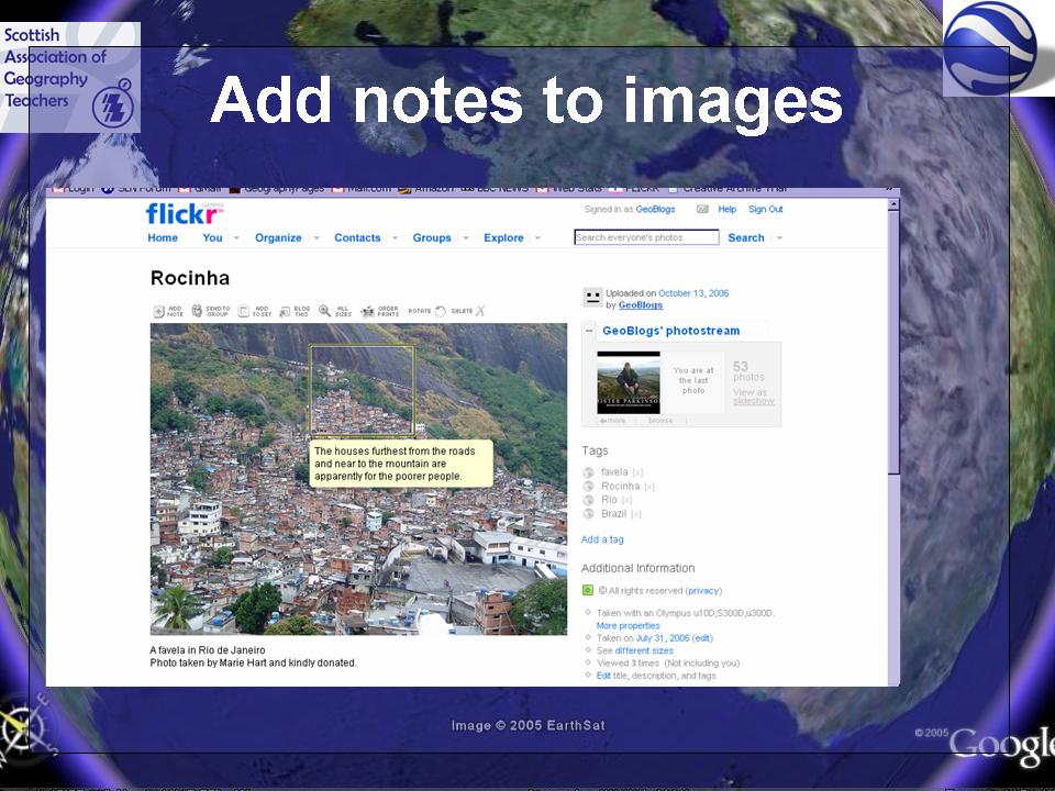
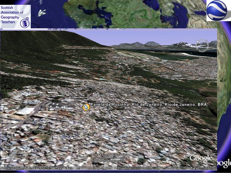 How to add the Favela picture ? Using FLICKR to host the image. FLICKR also allows the use of notes on images to add more detail. Students could be asked to add notes to images. Perhaps as tracing or OHT overlays, or using callouts in Word if FLICKR is blocked (as it is at my school)