Showing posts with label Google Maps. Show all posts

Friday, April 02, 2021

500 up

A small milestone perhaps, compared to the 10 000+ posts over on LivingGeography, but passed 500 posts on this blog, which has actually been around for quite a while, in fact predating LivingGeography. The blog began as part of a project funded by the Royal Geographical Society's Innovative Geography Teaching grants - I've received quite a few of them over the years.

It has broadened beyond Google Earth to take in Digimap for Schools and then ESRI's ArcGIS Online and StoryMaps.

Meanwhile Google Earth has changed, moving to the PRO download, which is still my preferred format, and now the Chrome browser version with its Projects builder option....


Tuesday, January 19, 2021

RIP MTJ

 I heard earlier today about the passing of Michael T Jones via Ed Parson's Twitter feed.

He was one of the people behind the development of Keyhole, which later became Google Earth.

For over 15 years, this tool has helped to revolutionise our geography teaching and also the way we, and students conceptualise the earth.

"We are going to make discovering the Earth a joy - like you're dating a planet and you want to know it, to hear all about its past and hopes. That's what we did: we made something immersive and engaging and personal. You can fly to your home--fly to your parents' home - and remember the time you snuck out in the backyard and did something you shouldn't do, or the place where you had a first kiss, or the place you got married."

This article from 2013 outlines some of his thinking, as downloads passed one billion.

Wednesday, July 01, 2020

Mapping our Future - from paper to pixels

A programme on how Digital Mapping and Paper Mapping interact. What are these map apps doing to us?

Jerry Brotton programme can be listened to on BBC Sounds. 
From paper to pixels... Mapping of the Coronavirus as an example of why it is important...
A good input from Ed Parsons on the dynamic nature of digital mapping and the change in map projection - from Mercator close in to a globe zoomed out. Google Earth as "a browser for the planet". This also shows no national borders... and referencing Tobler's first law of Geography.
Plenty of other good contributions as well.
Apple and Google worked together on a contact tracing app.
References 'Powers of 10' which I use to explore scale, and 'Earthrise'.
Reference to the Ordnance Survey's origins as well, and its military origins, and the US military's involvement in Keyhole - the forerunner of Google Earth. Earth Observation Satellite programme was also called Keyhole.

"Surveillance capitalism" is a useful phrase for some of the work of these large organisations in a book by Shoshona Zuboff.

It also mentionsWilliam Morgan's vast map of London.
Mentions the commercial information which blocks out some other information on the map.

A map of the human population is being created by our interactions with these digital maps. Counter-mapping is challenging this work.
Interested to read about Poly-Olbion

And the work of Stephen Walter of course.

Finishes with Borges 1:1 scale map of the Empire. The only truly accurate map, but its size makes it useless... All maps pursue certain agendas and define the way in one way rather than another.
Corporations are mapping the world....
Don't give up completely on the paper map.
Well worth listening to.

Monday, June 26, 2017

Google Earth Education

Launched in the last day or so: a new set of tools and resources and a rebrand for Google Earth continues, with this new Google Earth Education section.
See the resources and tools here.

More to come when I get the chance to explore in more detail...

Friday, August 05, 2016

Pokemon Go

Plenty of GIS related stories here... I've been saving a few of the stories, and collated a Google Document….

Google virtual Favela tour

Google has been working in the favelas of Brazil to produce a virtual fieldtrip experience which, with the Olympics about to start in earnest (some events have already started) is well worth taking a look at. Thanks to Ben Hennig for the tipoff to this resource.

Favelas are being mapped because "a big part of having an identity is having an atlas".
They are not just a place, they are a people, and to fully understand them, you must go inside...

This is colourful and is well worth experiencing (make sure that you wear your headphones when you do)


Sunday, July 05, 2015

Google MyMaps in Google Drive


You can now make your own MyMaps from within Google Drive...

Sunday, September 14, 2014

Better quality imagery in Google Maps

A Telegraph article describes a new satellite which is providing imagery and this will soon begin to improve the imagery in Google products...

Thursday, March 13, 2014

Google Maps Gallery

Google Maps Gallery has just been released, and it provides a lot to interest Google Earth users too.
This post on the Google Earth blog provides more details.

The aim of the gallery is to "help unlock the world's maps".

Friday, December 20, 2013

Merry Christmas and a Google Earth New Year

As with the last few years, you can follow Santa's journey on Christmas Eve via the Google SantaTracker tool.
The site is already 'live', with some fun games and other content but don't forget that nothing much will be happening Santa-wise before Christmas Eve....

Thursday, September 19, 2013

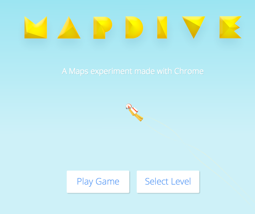
New sky diving game

Thanks to Keir Clarke for the link to the game.
You'll need to use CHROME to play it...

Sky dive onto famous landmarks, and steer between checkpoints and catch stars for points....

Give it a go...

Tuesday, June 11, 2013

Google Earth and Maps course now OPEN

The Google Earth and Maps course that I mentioned a while back has now gone live...

You can participate in courses for both Google Maps and Google Earth.
Go here for more information and to register.

More details on this YouTube video, introduced by Tina Ornduff, who I met at the Dublin Google event last year.


Once you've registered, you'll find out more about the course, which starts on June the 10th....

Why not join me ?

A few other new websites...

A few other Google Earth / Maps related websites which might be of interest...
The first is the Google Earth Engine.

Posted about this before, but a reminder of the environmental elements which can be accessed from the site.
Google Earth Engine brings together the world's satellite imagery — trillions of scientific measurements dating back almost 40 years — and makes it available online with tools for scientists, independent researchers, and nations to mine this massive warehouse of data to detect changes, map trends and quantify differences on the Earth's surface. Applications include: detecting deforestation, classifying land cover, estimating forest biomass and carbon, and mapping the world’s roadless areas.


Also check out the GeoData portal from Tufts University in the USA.

Plenty of layers which can be accessed using the search function, and then adding them to the cart (which enables a download of the data - often in shapefile format)
The shapefiles could presumably then be opened in ArcGIS Online.

There is a user guide which can be accessed by clicking the tab top right....
Thanks to Keir Clarke for the link to the site....

Wednesday, May 29, 2013

Google Maps and Google Earth course

I've just enrolled to take part in a new free course that is being offered by Google.
Introduction to mapping with Google.

You can participate in courses for both Google Maps and Google Earth.
Go here for more information and to register.

More details on this YouTube video, introduced by Tina Ornduff, who I met at the Dublin Google event last year.


Once you've registered, you'll find out more about the course, which starts on June the 10th....

Why not join me ?

New Google Maps...

I'll report back what I think in a few days time...


Wednesday, May 22, 2013

LocateStreet

Uses Google Maps rather than Google Earth, but worth a mention here...

You may have seen on my earlier post on GeoGuessr the mention for LOCATESTREET 

This is a variation on GeoGuessr, with various points being offered for guidance, although the Elevation option doesn't offer that much help...

You can choose to play on a Global basis, or other scales.

You are presented with 4 options of location to choose from, and if you pick the correct option you can earn bonus points for clicking on the actual location on a map...
The site takes you to some fairly out of the way places... I seemed to end up on rural roads, and in cul-de-sacs on industrial estates quite often.

Hardcore players should choose the GLOBAL option... and discover that South America looks a lot like Australia in places...
Choose the COUNTRY option, and explore a range of countries from a list, which includes the UK. This offers potential for a CITY based search for example.
There are also some US based Thematic search options.

The game is addictive. Had to stop myself playing on it last night....
If you get one of the highest scores so far you can enter your e-mail to be added to the High Score table. May be an incentive for some to use additional 'support' to search for business names etc., but that wouldn't be in the spirit of the game...

Also, while playing, I've come across a few random sights.
This looks like some sort of hawk diving into a field to catch something ?


And what is this bloke doing standing in the road ?


The game was developed by Nick Burkhart of Chelonia Labs in California.

As with GeoGuessr, there are various clues that you can look for to help with locating yourself in fairly random housing estates.

Telephone dialling codes tend not to be blurred out. 020 will tell you that you're in London.
If on a main road, head for junctions where there'll be road signs.
Look at the vernacular building materials - some places have distinctive stone or house designs.
Become familiar with the basic geography of London, which features heavily in the UK option.

Be aware though, that they can be misleading. I spotted a Yorkshire registration on a motorbike, which ended up being up in the far north of Scotland, flipping tourists...

Saturday, December 08, 2012

Google Mapping news

An interesting Guardian article about the efforts of Google to update their maps.
Some useful links here too, including this image.


Thursday, October 11, 2012

SkyFall Google Maps promotional game...


This is the trailer for a nice interactive game. It involves looking at Google Earth place marks and other sources to find the answers to clues. It's intended as a tourist promotion, but it's nicely done...

Go HERE to sign up as an agent and try your luck... Can you beat AGENT PARKINSON....


Thanks to 'Miss Moneypenny' at the GA for the tipoff...

Sunday, June 10, 2012

Google GeoTeachers Institute

I shall be in Dublin on Wednesday and Thursday this week to attend the Google GeoTeachers Institute. This will be an interesting event, given my long-term association with using Google Earth and other associated 'products' as a teacher and educator.


This goes back to the launch of Google Earth over six years ago. At the time, I got in touch with Google expressing my interest in developing materials, and they gave me a free year's license for the PRO version at the time to explore and play with, and also was successful in being awarded an Innovative Teaching award by the Royal Geographical Society to develop a users guide for Google Earth. I also started this blog at the same time, so it has been going for nearly six years as well.

Over the years since, I've been involved in a range of projects involving Google Earth, including the recent ICT Toolkit books which I edited for the GA, and the continuing work with teachers in my role at the GA, and now as a freelance geographer.
I also produced some resources for the newly launched Google World Wonders project.

Google Earth is still being developed and expanded all the time, and it is still a tool that teachers want to use.
In fact I've got an event in October in my diary when I'm going to be using it with the teachers of Aberdeen and surrounding area.

I'll be interested in hearing about a potential response to Apple's decision to have its own mapping.
Also interested in hearing about Street View Trekker, which is able to be carried into places that cars and trikes can't reach.

If you're coming along to the event too, come and say hi.

Wednesday, August 22, 2007

Google Maps now embeddable

Create a map.
Click on LINK TO THIS MAP.
Copy the code
Paste into blogger posting
Hey presto...


View Larger Map