Showing posts with label Digimap for Schools. Show all posts

Tuesday, October 13, 2026

EDINA / OS free access to Digimap for Schools scheme

A reminder that if you teach in a school in one of the more deprived area of the country, you can get free access to Digimap for Schools. 

This is not linked to the quality of provision in your school, but in your geographical location. I am told that many of the schools who are eligible for free access to Digimap for Schools - a saving of over £100 from your budget, have not yet signed up. Go here to check your eligibility.

Wednesday, April 27, 2022

Digimap for Schools Webinar

Earlier today I presented a webinar with ideas for using Digimap for Schools.

The theme was FIELDWORK. Linked to the GA's National Fieldwork Week.

I remember the launch of the service, which came after the previous chance for teachers to claim a free Ordnance Survey map for all 11 year olds.

I also wrote a great many of the resources for the service, which is one of the few resources to have gained the prestigious GOLD award in the GA Awards. 

Here are the slides I used for my webinar - those who came along will be sent a link to the recording, and I will add that here as an update to the post once it's available and badged up. 


It wasn't as epic as Kit Rackley's recent webinar but seemed to go down well. 
Thanks to all those who attended... a good number.

Tuesday, April 19, 2022

New Digimap for Schools Webinar

Come and have a listen...


Friday, April 02, 2021

500 up

A small milestone perhaps, compared to the 10 000+ posts over on LivingGeography, but passed 500 posts on this blog, which has actually been around for quite a while, in fact predating LivingGeography. The blog began as part of a project funded by the Royal Geographical Society's Innovative Geography Teaching grants - I've received quite a few of them over the years.

It has broadened beyond Google Earth to take in Digimap for Schools and then ESRI's ArcGIS Online and StoryMaps.

Meanwhile Google Earth has changed, moving to the PRO download, which is still my preferred format, and now the Chrome browser version with its Projects builder option....


Tuesday, September 08, 2020

Developing Place knowledge - a new DfS resource

Simon Catling and Emma Espley have been working on some new materials for the resource area of Digimap for Schools, designed for subscribers, but free to access by all.

Digimap for Schools gave free access to their service to schools during lockdown, and I am sure many will have found it a useful and effective resource.

The resources explore Place Knowledge using the new global mapping along with the familiar Digimap tools...

Thursday, April 02, 2020

Free access to Digimap for Schools until the end of July

In an effort to help students and parents during this challenging time of isolation and home schooling, Digimap for Schools will be free for any school to access from today until the end of July 2020.

If you are an existing Digimap for Schools subscriber, they are automatically extending  subscriptions by four months, at no cost, subscribers don't need to do a thing.

Saturday, October 12, 2019

Digimap v2

Having an early play with this today. 
A new, improved version 2 of the GA Gold Award winning Digimap for Schools.

Information from Edina.

Digimap for Schools - the definitive global digital atlas for schools


The Digimap for Schools Team are pleased to announce the imminent arrival of a new version of their award winning schools service.

This new version has all the mapping products and functionality Digimap for School users are already familiar with (Ordnance Survey mapping, historical data and aerial photography for GB, drawing tools, image library, webinar and training support), but adds:

Global mapping
- incorporation of the beautiful and authoritative Collins Bartholomew World Panorama product providing a definitive global school atlas


- the same wonderful Ordnance Survey data for Great Britain and beyond GB for the rest of the world, detailed street level mapping from Open Street Map:


An updated and modern intuitive User Interface has been added - this is similar to the one on the DataNation website which is an optional upgrade for schools who don't already have Digimap for Schools perhaps. It also includes a useful additional option to find your location and zoom to it, rather than using the search, or drawing a rectangle as currently.


The new version of Digimap for Schools will be available from November 2019 at http://digimapforschools.edina.ac.uk

Access to the old version will remain available from the same address.
The existing Digimap for Schools version will remain supported until January 2021.
Schools resubscribing to Digimap for Schools before March 2020 will be able to chose between the old version and our new enhanced Global version.
From March 2020 subscribers will only be able to take our new enhanced service.
(Re)subscription will be on a rolling twelve month basis as is the case now. It will not be possible to subscribe to both new and old versions.

As always, the Digimap for Schools Team are happy to respond to any questions or concerns you may have over on the website.

Saturday, May 26, 2018

Mapping urban change

Another of the outcomes from the ESRI UK Annual Conference was awareness of the Urban Growth Explorer tool
This uses a swipe tool to explore the changes in the growth of key cities.


It's also worth remembering that there are some similar tools in Digimap for Schools - here's a short video explaining how that can work too...

Wednesday, January 24, 2018

Digimap for Schools resource revamp


Over the last few years, I've written a number of Secondary resources to accompany the Digimap for Schools service. My colleague Paula Owens wrote a whole tranche of Primary resources too.

The resource area has now had a revamp so that it is easier to access particular resources from the archive.

The new look page can be accessed HERE.

It has resources for a range of subjects, not just geography, which is a reminder that if you are thinking of getting a subscription for your school, you should make a point that it is not just for geography, and have it paid from general budgets rather than your own budget...

Monday, May 01, 2017

Digimap review - a chance to get involved

The service is run through the University of Edinburgh, and there is now a project underway to assess the overall impact of the mapping service across those schools which make use of it.

I'm going to be sharing my views, and there is an opportunity for you to share yours.

You can contact Michael Gallagher here if you'd like to be involved in adding your views to the review of the service.
There are now over 2700 schools using the service, which is a real success compared to the numbers when I first got involved, and was asked to write some of the resources for secondary teachers.
Here's Michael's request - you'll notice it is not just Geography teachers that he is interested in speaking to.

I would love to speak to any and all teachers in the UK interested in ICT use as part of their teaching. Not a geography teacher? Not a problem. I want to speak to teachers across the curriculum. History, literature, science, math, and geography. This evaluation is not only about Digimap, but also about ICT use broadly. Not confident in your ICT use? Not a problem. Never used Digimap? Truly not a problem. I want to learn more about your teaching and how ICT enters into that (or not, depending). I want to learn about your teaching approaches, want to know what you think are barriers to attainment and satisfaction, what you see are some of the larger issues surrounding incorporating these types of applications into your teaching.

Remember that the service is updated with new features regularly.
Most recently, there is the chance to view GeoGraph photos through the Digimap service.

Friday, October 28, 2016

New Digimap for Schools resources

There is a whole new set of resources now available to download to accompany the Digimap for Schools tool.

They have been written by Will Tuft, and although they are written with the Scottish Curriculum for Excellence in mind, they would be useful for anybody teaching the relevant topics.

If you want to hear more of Will's work, you can hear him being interviewed by John Johnston on the EduTalk Radio podcast website.
He is talking about his ideas for the immersive classroom. This involves an element of storytelling, suspension of disbelief, and setting up the classroom around a particular scenario.  It was interesting to hear that I got a mention near the start of the programme, when Will describes how Russel Tarr and Matt Podbury's lessons based on my Ice Man book were the inspiration for the work. Will be seeing Russel and Matt next week at Practical Pedagogies (of which more to come on the blog over the next week or so...)

Check out Will's blog here too, for some of his ideas.

Thursday, May 05, 2016

New updated Mapstream page


A few years ago now, I wrote a whole suite of lessons for Edina's MapStream for Schools service. For those who don't know what this is, it's a streaming service for the Ordnance Survey's mapping. Unlike Digimap for Schools, which has a set of tools that come with it, this provides a stream of the maps themselves, which can then be visualised by another GIS tool, such as QGIS.

Check out the updated website… and the resources… and MapStream….


Wednesday, October 14, 2015

New features on Digimap for Schools endorsed by...er... me

A couple of new additions to the growing list of features for subscribers to Digimap for Schools.

From the EDINA blog...
 
Today the Digimap for Schools team release two new wonderful features – 1950s OS historic mapping and a text box tool.
 
The 1950s mapping fill in the mid point time period between the 1890s and current OS mapping.  The 1950s mapping are perfect for comparing changes over time and exploring the landscape, urban areas, road network and other features of post-war Britain.
We’ve made a small tweak to the interface to enable the selection of any two time periods, using the buttons and the slider (shown below) you can choose whether to view 1890s, 1950s or mapping from today, and any combination of two maps.
New map selection and slider
When a decade button is blue, click it to toggle it off and switch on the other map.  You can watch a demo video on the Digimap for Schools YouTube Channel
The 1950s mapping is lovely to look at and a wonderful addition to the mapping available in Digimap for Schools.  The maps have been provided by the National Library of Scotland.
The other great feature we’ve added, is the ability to add a text box to your map.  Until now, users have only been able to add short text labels which is a bit restrictive when you want to write a longer piece of information to annotate the map.
The Text Box tool can be found in the Annotations Toolbar in a sub-menu of the Label tool.
Text box tool
Click to activate the tool and click on your map to add the Text Box.  Then simply click in the box to start typing.  Resize the box to display as much text as you like!
 
There's also a quote from a user of the service...

"This new map layer offers scope for further historical comparisons of local areas, and the impact of more recent changes than the previous 1890s addition.
I traced the railway network that used to pass through my village before Beeching's cuts, and looked for clues of the many farms that now lie beneath the urban sprawl of Milton Keynes. I traced the transformation of the Isle of Dogs, and the steady infill of housing in small villages.
 
The new maps are the latest in the continued improvements that are being made to this essential tool for the Geography department"

Alan Parkinson, Head of Geography at King’s Ely (Junior) School

Monday, August 17, 2015

Some nice thoughts on GIS in the Curriculum

Two good posts on the Leicester DIGILIT blog from Rob Manger of English Martyr's School.

The first followed Rob attending a course that I led in the city for the GA a few years ago, and covered Google Earth and some other technologies. At the time, ArcGIS Online was just coming out and offered some real promise.

Worth downloading the documents which accompany this post.

The second brings Rob's thinking up to date, with some thoughts on Digimap for Schools. ArcGIS Online and others, including the new CSV upload feature, Raphael Heath's work and the new GeoForm.

Rob has taken a lot of time to develop his skills in GIS, including attending the recent UK ESRI User Conference in London. I look forward to seeing what he and his students produce next.

If you've used Digimap for Schools in your own school, let me know what you've been up to and I'll share it here.

Friday, August 14, 2015

CSV upload added to Digimap for Schools

A new feature has been added to Digimap for Schools.
Subscribers can now upload CSV files of fieldwork data/locations and the values will be plotted at the location within the postcode where they were recorded, along with a text label if required.

You can watch a tutorial video here.


 Give it a go and let us know how it works for you.

The Add points from a file marker tool allows you to upload a CSV file containing data you have collected and create points on your map. For example, if you have been out on fieldwork and collected data in a spreadsheet or mobile app, you can upload that data and represent points on your map. Your points must have a location element to them, either Easting and Northing coordinates, Latitude and Longitude coordinates or a full GB Postcode. The data you have collected might be recording certain tree species, places you have observed micro climatic conditions, locations of graffiti or the postcode of people you have surveyed in a tourist hot spot.

Wednesday, July 15, 2015

CSV uploads in Digimap for Schools

I've worked on a range of resources for Digimap for Schools and Digimap for Colleges over the last few years, and am always excited when a new tool is added.
Three new tools were added this week.
You'll need to login and then look at the ADD MARKER dropdown options to see them.

Stickman marker could be used to mark human influence on an area, and colour coded for good or bad impact e.g. in a National Park, or along a stretch of coastline...

Grid Reference marker will be useful for adding them to printed maps which are used for fieldwork purposes, so that they can be used by students, perhaps in association with the OS Locate app.

You can now also add in CSV files of locations.
There is a help page for this function.


Read the blog post to find out more. The upload function won't work if you are using DfS on an iPad

Don't forget that printed maps also now have a north arrow included on them.

Tuesday, April 23, 2013

Digimap for Schools MapStream - WMS for Google Earth

At the start of the year I finished off a project with EDINA, who operate the Digimap for Schools MapStream service, in association with the Ordnance Survey.
This is a little like the Digimap for Schools tool, but without the tools...
Subscribers to MapStream will find that they have access to the Ordnance Survey's mapping at the same scale as Digimap, but the difference is that they stream them into their own GIS software using a WMS (web mapping service) - this works with open-source options such as Quantum GIS, but also ArcGIS and even Google Earth (I was amazed when I first saw this in action...)

One advantage of this option is that the maps are streamed to your GIS as an extra layer, so there is no data storage / installation issue. Having said that, you need a reliable and fairly fast internet connection if you want the maps of course. The cost is much cheaper than Digimap, but you need to use the tools in your GIS client, rather than the ones provided by Digimap. This may require extra time on training how to use your chosen GIS package.
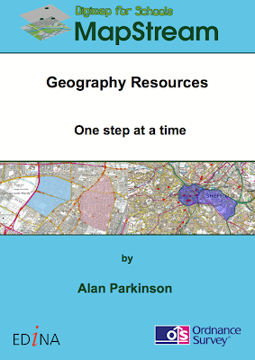
If you head over to the site, you will now find that there are the first of what will be a series of educational materials for teachers, available for free download. These are particularly designed for subscribers to the MapStream service.
I wrote the materials, the cover of one is pictured to the right....
Check them out.
Subscription is just £35 a year for a primary school and £50 for a secondary school.

I will be referring to this, as well as other mapping options in my GA CPD days which will take place in Birmingham at the end of May and London at the start of June.