Thursday, December 08, 2016

Google Earth and Satellite Image workflow

Earlier today, was contacted by Mark Brandon, who let me know about a workflow that he had put together to get satellite imagery into Google Earth.
Mark wanted to explore getting satellite images into Google Earth, and used Worldview as the data source.
Mark has provided a really helpful step by step guide, and even made a short film, which can be seen below:

Sunday, November 27, 2016

Little Planets

Thanks to Karl Donert for the reminder of this post on the Google Earth blog which describes the "little planets" created by Janis Petke.
There's an example shown below, of London. I love these. There are some instructions for how to go about making your own, but I guess they take quite a long time. I have an app which produces a similar effect, but nowhere near as detailed and crisp as these.


Images made by Janis Petke

Friday, November 18, 2016

Starbucks StoryMap

A few months ago, I finished some work for COSTA and created a StoryMap to connect with the work. Here's another one, that was produced to tell the story of Starbucks.
Another example of the power of StoryMaps.


Friday, October 28, 2016

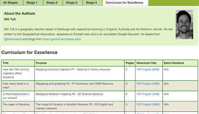
New Digimap for Schools resources

There is a whole new set of resources now available to download to accompany the Digimap for Schools tool.

They have been written by Will Tuft, and although they are written with the Scottish Curriculum for Excellence in mind, they would be useful for anybody teaching the relevant topics.

If you want to hear more of Will's work, you can hear him being interviewed by John Johnston on the EduTalk Radio podcast website.
He is talking about his ideas for the immersive classroom. This involves an element of storytelling, suspension of disbelief, and setting up the classroom around a particular scenario.  It was interesting to hear that I got a mention near the start of the programme, when Will describes how Russel Tarr and Matt Podbury's lessons based on my Ice Man book were the inspiration for the work. Will be seeing Russel and Matt next week at Practical Pedagogies (of which more to come on the blog over the next week or so...)

Check out Will's blog here too, for some of his ideas.

Saturday, October 01, 2016

400th post

This blog has developed quite a lot since the original incarnation when I started a project to support the appearance of Google Earth.
Thanks for reading so far. Plenty of mapping and developments still to come I'm sure….

Wednesday, September 28, 2016

Google Earth showing earthquake damage

A great Temblor post showing the imagery in Google Earth and how it shows damage using the colours of buildings which are being repaired.

Wednesday, September 07, 2016

Digimap for Schools - new aerial photographer layer(s)

From the letter received this morning by subscribers....


Digimap for Schools now contains a wonderful new addition that many of you have asked for over and over again – aerial photography!
We are thrilled at the addition of this new data, kindly donated by Getmapping Plc.
The aerial photography shows magnificent detail and clarity - it's cloud free for all of Great Britain, something you won't get anywhere else!  You can now compare and fade Ordnance Survey maps, historical maps and aerial photography with our new enhanced Map Chooser (shown).  It's simple to use and offers maximum flexibility.
We've also added new learning resources to accompany the aerial photography.  Be inspired with ideas such as using aerial photography to introduce learners to travel, transport and trade or discuss marks we humans leave on the landscape that can be seen in aerial imagery.  Both excellent ideas to get you started with aerial photography.
To make you get the most out of this new addition to Digimap for Schools, we've created a short introductory video which explains the difference between Aerial and AerialX, the info tool for discovering exact dates the aerial photography was flown in your area of interest and a map key showing the patchwork of years stitched together to form this seamless dataset.  
And of course there is a revised Help section on How to .... fade between map types.


Here's the video, and more videos and webinars are on the Digimap for Schools YouTube channel.


Friday, August 05, 2016

Pokemon Go

Plenty of GIS related stories here... I've been saving a few of the stories, and collated a Google Document….

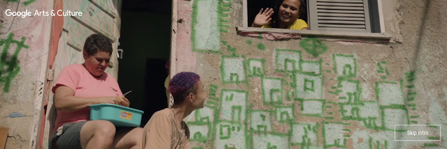
Google virtual Favela tour

Google has been working in the favelas of Brazil to produce a virtual fieldtrip experience which, with the Olympics about to start in earnest (some events have already started) is well worth taking a look at. Thanks to Ben Hennig for the tipoff to this resource.

Favelas are being mapped because "a big part of having an identity is having an atlas".
They are not just a place, they are a people, and to fully understand them, you must go inside...

This is colourful and is well worth experiencing (make sure that you wear your headphones when you do)


Saturday, July 02, 2016

ESRI Video

One of a few on the ESRI page...


Saturday, June 25, 2016

Brexit cartogram

It was good to spend time with Ben Hennig at the GIS Day that we hosted at my school on Tuesday. 
I was expecting Ben to produce a map of the referendum results and he has delivered as expected.
He describes the map as follows:

The following map is a cartogram that shows the electoral areas from this referendum resized according to their total number of people entitled to vote. In addition, the vote share for leaving and remaining is shown in differently shaded densities, using blue for the remain votes and red for the leave votes (which complement each other to 100% of the valid votes)

Image created by Ben Hennig and shared under CC license - click for a bigger version

GI Learner

GI Learner

I am involved in this project which has been funded by ERASMUS+ for the next three years.
I will be researching and producing resources on the theme of GI in schools.
The first resources I am creating are on the theme of the LOCAL for K7
Check out the GI Learner website
Follow the Twitter feed for the project.


ArcGIS Online - thanks for sharing...

Saturday, May 07, 2016

Early bird still open for Practical Pedagogies 2016

I was due to present at the first running of this event last year, but was unable to go as it clashed with my trip to Iceland, and return to full-time teaching, so had to pull out.

Russel Tarr has pulled together another excellent programme of events which will take place in the first week of November, and this time I can make it. In fact I'm already booked for my flights, and my colleague Claire is coming along too, which is a bonus!
Just got to sort my accommodation now.

I will be presenting at Practical Pedagogies 2016.

EARLY BIRD BOOKINGS ARE NOW AVAILABLE

The full programme is HERE.

My session is called 'The Power of Geographical Information', and is described below:
The Power of ‘Where’: Geographical Information in the curriculum

Geography is an academically robust subject which spans the social and physical sciences and promotes a lifelong interest and fascination in how the world works.
Nicholas Crane, President of the Royal Geographical Society
Abstract

Geographers are interested in spatial patterns, and the growing availability of, often real-time, location based information brings new depth to teaching geography. Students don’t only consume this information, but they also produce it themselves, and it is also used after natural disasters to aid the relief effort.

The workshop will explore how this renewed focus on the ‘where’ can bring new ideas to teach familiar topics, but also broaden these activities into other curriculum areas. It will include ideas from several ERASMUS-funded projects, a resource on transport geographies, a project for the British Red Cross and work completed in the classroom by pupils.

So there'll be plenty on digital mapping and its use in the classroom.

You’ll leave the session with some practical pedagogical resources to adopt and adapt, and ideas for personal innovation, as well as introducing some free tools and mobile apps.


Matt Podbury has shared some of the other Geography names who will be presenting at the event over on his fine GeographyPods site.

See you there?

Thursday, May 05, 2016

New updated Mapstream page


A few years ago now, I wrote a whole suite of lessons for Edina's MapStream for Schools service. For those who don't know what this is, it's a streaming service for the Ordnance Survey's mapping. Unlike Digimap for Schools, which has a set of tools that come with it, this provides a stream of the maps themselves, which can then be visualised by another GIS tool, such as QGIS.

Check out the updated website… and the resources… and MapStream….