Instructions by Noel Jenkins which I used on the recent GA Course on Google Earth and Beyond.
They worked well...
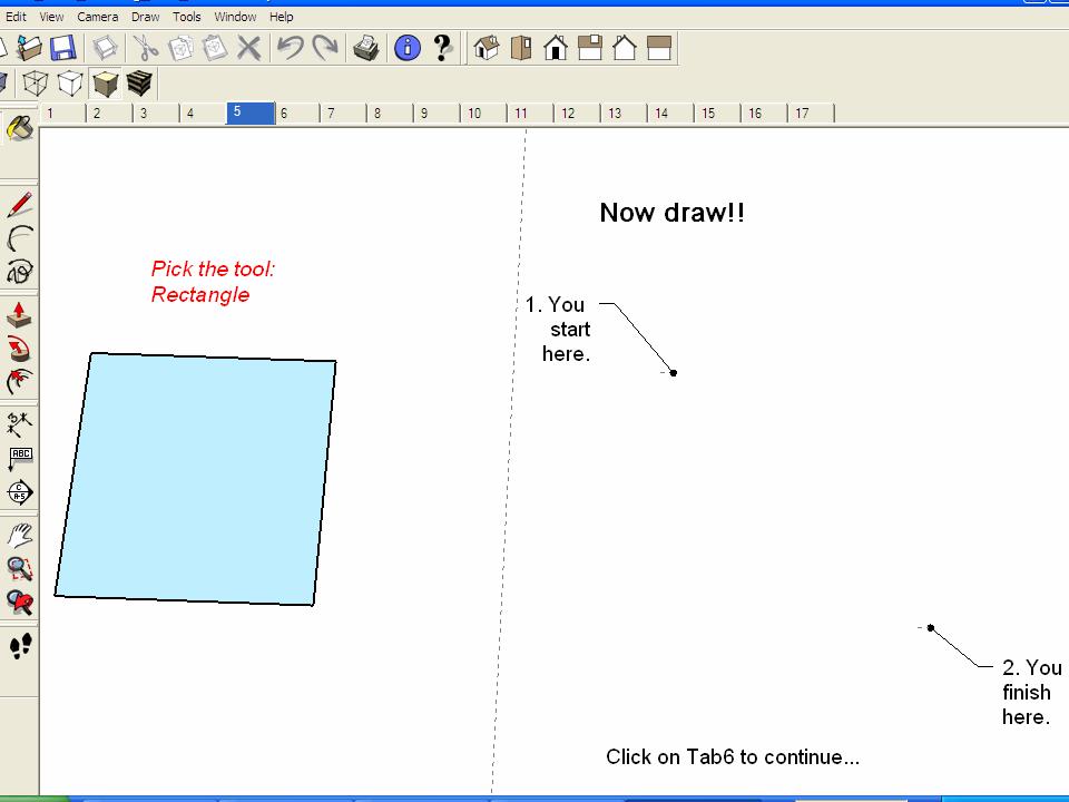
Follow the instructions to grab a model from the SketchUp Warehouse and place it wherever you want on Google Earth...
It's worth saying that you'll need to have SketchUp installed on your computer to do this.
SketchUp Warehouse has undergone a substantial face-lift since the last time I visited last year and now has various new options and a range of new models.
Models can also now be embedded as a preview in 3D
Here's the MARACANA stadium in Rio de Janeiro...
Showing posts with label Noel Jenkins. Show all posts
Showing posts with label Noel Jenkins. Show all posts
Sunday, May 25, 2014

Tuesday, December 11, 2012
Noel's Sketch-Up tricks...
A new post on Digital Geography from Noel Jenkins...
Great ideas for simplifying the use of Sketch-Up models in the classroom.
Great ideas for simplifying the use of Sketch-Up models in the classroom.
Sunday, October 05, 2008
Web 2.0 makes a difference, and some new Noel
Since I started all this blogging and social networking thing, various people have questioned its value, and although I knew that it made a difference it was hard to 'quantify' that difference...
A BECTa report into the value of these tools has now been published...
Becta has published major new research into the use of Web 2.0 technologies, such as wikis, blogs and social networking, by children between the ages of 11-16, both in and out of the school environment.
The reports found that young learners are prolific users of Web 2.0 technologies in their leisure time but that the use of Web 2.0 in the classroom was limited. However, schools and teachers who are innovating in this area have found benefits, such as:
* Web 2.0 helps to encourage student engagement and increase participation – particularly among quieter pupils, who can use it to work collaboratively online, without the anxiety of having to raise questions in front of peers in class – or by enabling expression through less traditional media such as video.
* Teachers have reported that the use of social networking technology can encourage online discussion amongst students outside school.
* Web 2.0 can be available anytime, anywhere, which encourages some individuals to extend their learning through further investigation into topics that interest them.
* Pupils feel a sense of ownership and engagement when they publish their work online and this can encourage attention to detail and an overall improved quality of work. Some teachers reported using publication of work to encourage peer assessment.
The research also found that over half of teachers surveyed believe that Web 2.0 resources should be used more often in the classroom. However, the majority of teachers questioned had never used Web 2.0 applications in lessons, despite being frequent users of technology in their personal and professional lives. Their main concerns involved a lack of time to familiarise themselves with the technology and worries about managing the use of the internet in class.
The reports recommended that teachers should be encouraged to help learners to develop more sophisticated use of Web 2.0 technology and to give them the skills to navigate this space.
Tony Richardson, Executive Director Strategy and Communications, said:
"Some schools and individual teachers have been very innovative in developing their use of Web 2.0 to support learning. However, clearly teachers need the support, time and space to develop skills and practices that will allow them to integrate Web 2.0 into lessons. The report shows that the impact that Web 2.0 can have on the motivation and engagement of pupils. We need to ensure that these benefits are extended to all learners."
All very encouraging, and in many Scottish schools, as was apparent at last week's Scottish Learning Festival, this was flourishing...
Down here in England, perhaps less so. There are some innovators out there...
I'd like to work with those innovative geographers and gather some examples of how people are making use of the social web tools to engage learners.
Please get in touch if you would like to showcase something that YOU do....
Check out NOEL's DIGITAL GEOGRAPHY blog where he has 2 new posts on how to use Google Earth to teach SPHERE OF INFLUENCE...
A BECTa report into the value of these tools has now been published...
Becta has published major new research into the use of Web 2.0 technologies, such as wikis, blogs and social networking, by children between the ages of 11-16, both in and out of the school environment.
The reports found that young learners are prolific users of Web 2.0 technologies in their leisure time but that the use of Web 2.0 in the classroom was limited. However, schools and teachers who are innovating in this area have found benefits, such as:
* Web 2.0 helps to encourage student engagement and increase participation – particularly among quieter pupils, who can use it to work collaboratively online, without the anxiety of having to raise questions in front of peers in class – or by enabling expression through less traditional media such as video.
* Teachers have reported that the use of social networking technology can encourage online discussion amongst students outside school.
* Web 2.0 can be available anytime, anywhere, which encourages some individuals to extend their learning through further investigation into topics that interest them.
* Pupils feel a sense of ownership and engagement when they publish their work online and this can encourage attention to detail and an overall improved quality of work. Some teachers reported using publication of work to encourage peer assessment.
The research also found that over half of teachers surveyed believe that Web 2.0 resources should be used more often in the classroom. However, the majority of teachers questioned had never used Web 2.0 applications in lessons, despite being frequent users of technology in their personal and professional lives. Their main concerns involved a lack of time to familiarise themselves with the technology and worries about managing the use of the internet in class.
The reports recommended that teachers should be encouraged to help learners to develop more sophisticated use of Web 2.0 technology and to give them the skills to navigate this space.
Tony Richardson, Executive Director Strategy and Communications, said:
"Some schools and individual teachers have been very innovative in developing their use of Web 2.0 to support learning. However, clearly teachers need the support, time and space to develop skills and practices that will allow them to integrate Web 2.0 into lessons. The report shows that the impact that Web 2.0 can have on the motivation and engagement of pupils. We need to ensure that these benefits are extended to all learners."
All very encouraging, and in many Scottish schools, as was apparent at last week's Scottish Learning Festival, this was flourishing...
Down here in England, perhaps less so. There are some innovators out there...
I'd like to work with those innovative geographers and gather some examples of how people are making use of the social web tools to engage learners.
Please get in touch if you would like to showcase something that YOU do....
Check out NOEL's DIGITAL GEOGRAPHY blog where he has 2 new posts on how to use Google Earth to teach SPHERE OF INFLUENCE...
Tuesday, September 16, 2008
Google up your Coursework
Noel Jenkins has added a juicy little post on how to GOOGLE UP your GCSE COURSEWORK

Tuesday, December 18, 2007
A couple of quickies
First of all, from CREATIVE REVIEW'S blog, come 4 scenes from the Bible 'as they would be seen on Google Earth'... Check them out.
Also news from Noel Jenkins that for those teachers using his classic MONTSERRAT lesson, the quality of the images has been much improved. I remember using this a few years ago, and having to use an overlay as most of the southern part of the island was covered in thick cloud.
Also news from Noel Jenkins that for those teachers using his classic MONTSERRAT lesson, the quality of the images has been much improved. I remember using this a few years ago, and having to use an overlay as most of the southern part of the island was covered in thick cloud.
Sunday, June 03, 2007
Updates and Norfolk in high res finally....
New update for June
Just updated to latest version of Google Earth (always good to have an up to date version)
Thanks to Noel Jenkins for reminding me of this update.
The big news though is that there is now high quality imagery of Norfolk on Google Earth, and it includes my home village and the place where I work.
There is one issue though: the age of the images that are used.
The ones of my village are at least 5 years old and possibly nearer 7.
The ones of my school are about the same age, as they show a number of missing details. In fact: one of the tasks I might do with my groups next week is to play a SPOT THE DIFFERENCE game for the local area.
Here is an image of my brother in law's house in Norwich for example - I think that's his car, so they are within the last 5 years or so: Here is one of my house - and some neighbours:
 And here is one of the school where I work...
There appears to be a missing TESCOS !
Another piece of news on GEARTHBLOG was about a recent Developers' Day where it was announced that Google has acquired PANORAMIO: the source of million plus images in Google Earth.

Just updated to latest version of Google Earth (always good to have an up to date version)
Thanks to Noel Jenkins for reminding me of this update.
The big news though is that there is now high quality imagery of Norfolk on Google Earth, and it includes my home village and the place where I work.
There is one issue though: the age of the images that are used.
The ones of my village are at least 5 years old and possibly nearer 7.
The ones of my school are about the same age, as they show a number of missing details. In fact: one of the tasks I might do with my groups next week is to play a SPOT THE DIFFERENCE game for the local area.
Here is an image of my brother in law's house in Norwich for example - I think that's his car, so they are within the last 5 years or so:
 Here is one of my house - and some neighbours:
 And here is one of the school where I work...
There appears to be a missing TESCOS !
Another piece of news on GEARTHBLOG was about a recent Developers' Day where it was announced that Google has acquired PANORAMIO: the source of million plus images in Google Earth.

Sunday, March 18, 2007
Geograph Layer
 Thanks to Noel J (again) for a tip off of a new layer on Geograph which has updated the existing layers and allows you to see images which have been uploaded. Called the SUPERLAYER. Head over to GEOGRAPH and download the KML file.
Sunday, March 11, 2007
His Dark Materials
Noel Jenkins has consistently produced interesting resources for use with Google Earth, and he has now launched another excellent resource idea using text from Philip Pullman's award winning "Northern Lights". This is a book I read over 10 years ago and had a big impact ! The front cover of the edition I have shows the alethiometer: a very geographical looking device. In fact in the USA the book is published as 'The Golden Compass'. The needle seeks out 'truth' rather than true North...
The action in the first book ends with a whirl of events taking place in Svalbard, but not the Svalbard that we know - one that is subtly different i.e: it has armies of polar bears and witches in a parallel world, which has Norroway and Brytain.
Noel's idea is to use Google Earth to find the locations in the book.
This, as Noel says, is difficult on Svalbard except for the small areas where there are high definition images.
Check out NOEL's PAGE for more.
 Why not buy Northern Lights from the GeographyPages bookshop. Click the image below to go there then follow the link and spend spend spend !
 Noel uses the text to explore the landscape of Svalbard, which is shown in all its glory in the wonderful images of Laurel McFadden at her COLD PHOTO blog.
Also looking forward to the film, which is apparently due out in December 2007.
The action in the first book ends with a whirl of events taking place in Svalbard, but not the Svalbard that we know - one that is subtly different i.e: it has armies of polar bears and witches in a parallel world, which has Norroway and Brytain.
Noel's idea is to use Google Earth to find the locations in the book.
This, as Noel says, is difficult on Svalbard except for the small areas where there are high definition images.
Check out NOEL's PAGE for more.
 Why not buy Northern Lights from the GeographyPages bookshop. Click the image below to go there then follow the link and spend spend spend !Noel uses the text to explore the landscape of Svalbard, which is shown in all its glory in the wonderful images of Laurel McFadden at her COLD PHOTO blog.
Also looking forward to the film, which is apparently due out in December 2007.
Wednesday, January 17, 2007
Ordnance Survey Mapping News
All schools should receive a copy of OS Mapping News twice a year.
The Winter 2006 issue (Issue 31) has just arrived and features a few items of interest for Google Earth users.
There is an article on using Google Earth Plus (an upgrade which costs just $20) and a GPS unit to create and map a historic trail on Cyprus.
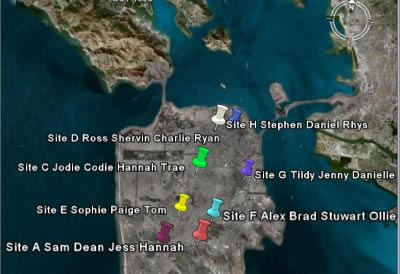
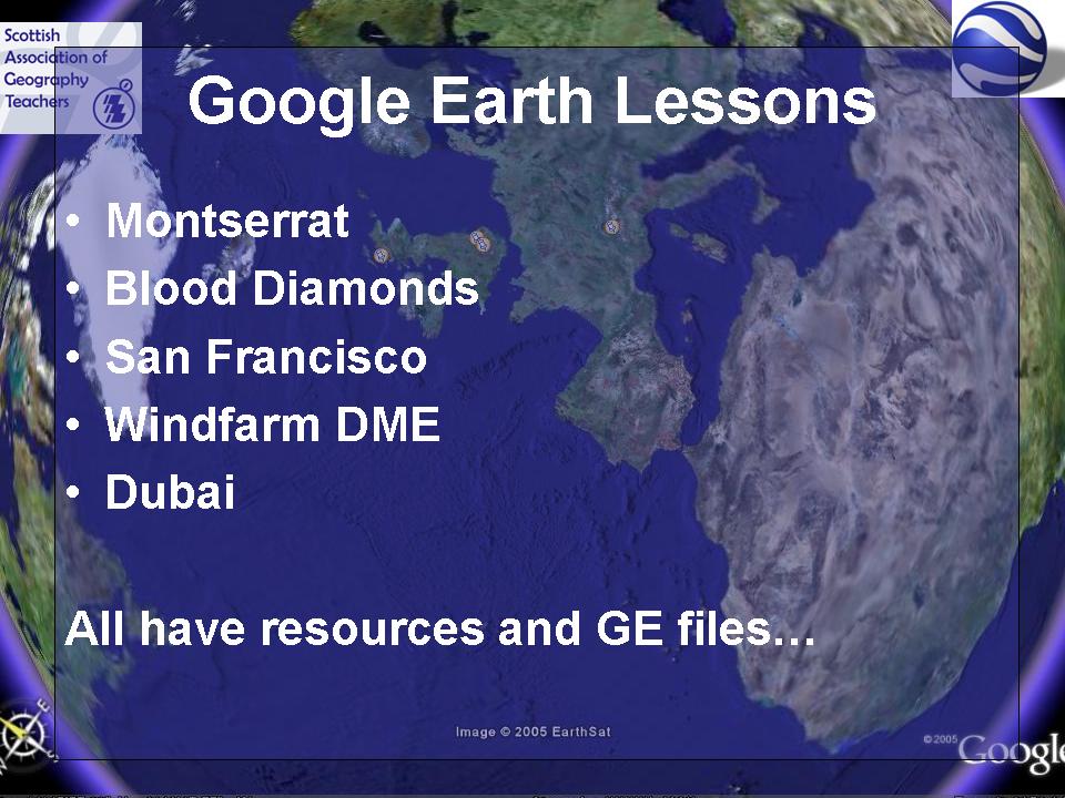
There is also an article by Noel Jenkins relating to his San Francisco activity "Visualising a Safer City" which uses Google Earth to look at decision-making related to the location of a new building in the city.
It includes a file to download, and the article gives all the details for working through this tried and tested activity.
There are full details at the JUICY GEOGRAPHY page, from where I borrowed this Google Earth screenshot.
Thanks to Noel for mentioning my GeographyPages Users Guide at the end of the article!
The Winter 2006 issue (Issue 31) has just arrived and features a few items of interest for Google Earth users.
There is an article on using Google Earth Plus (an upgrade which costs just $20) and a GPS unit to create and map a historic trail on Cyprus.
There is also an article by Noel Jenkins relating to his San Francisco activity "Visualising a Safer City" which uses Google Earth to look at decision-making related to the location of a new building in the city.
It includes a file to download, and the article gives all the details for working through this tried and tested activity.
There are full details at the JUICY GEOGRAPHY page, from where I borrowed this Google Earth screenshot.

Thanks to Noel for mentioning my GeographyPages Users Guide at the end of the article!
Saturday, January 06, 2007
Google Earth INSET Courses
Want some INSET on Google Earth ?
The RGS-IBG are offering a full day course looking at using Google Earth to create a Virtual fieldtrip by adding digital content. It's on the 22nd of January, and further details are available on the RGS website. School members should also have been sent flyers. The course is being run by Jamie Buchanan Dunlop and will involve fieldwork inHyde Park . It costs a very reasonable £30.
There are also some useful tips at the GE LESSONS website.
The RGS-IBG are offering a full day course looking at using Google Earth to create a Virtual fieldtrip by adding digital content. It's on the 22nd of January, and further details are available on the RGS website. School members should also have been sent flyers. The course is being run by Jamie Buchanan Dunlop and will involve fieldwork in
Noel Jenkins is also running a course in
Sunday, December 03, 2006
Sky News and Glaciers
Google Earth just been used by Sky News to zoom in to the location of a breaking news story.
Wednesday, November 29, 2006
Space Navigator
 Head over to 3DConnexion to find out more about the mysterious object pictured above, or read Noel's post at DIGITAL GEOGRAPHY.
Mine is currently on the way from Germany, and I shall let you know more when I get hold of it!
Saturday, November 25, 2006
Assessment of Pupil Work using Google Earth
Noel Jenkins has been innovative again.
He has published a link to some work done by his pupils on Google Earth, as part of his San Francisco assessment. You are invited to add comments to the pupil's work.
This has possibilities for an assessment for Pilot GCSE (or other specifications)
Friday, November 24, 2006
Image Update and some useful sites for educators
Stefan Geens over at OGLE EARTH has given notice of a recent image update which adds high quality imagery to some areas of the UK as well as some other useful locations - particularly interesting is the imagery of Darfur, plus 6 high-resolution regions in the UK (Bridgend, Cleveland, Dundee, Plymouth, Poole, Rochford)
Check out OGLE EARTH for a detailed lists of sites (including my own page), Noel's etc.
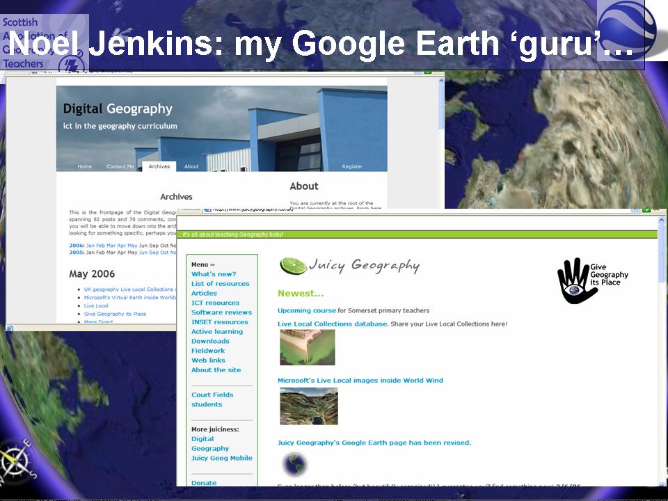
A reminder that Noel has now updated his JUICY GEOGRAPHY page to a nicely set out blog format. Some very good GUIDES to print off (including WINK presentations to demonstrate how to perform some of the tasks...)
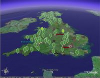
Also, over at ROBLOG there is the return of the Autumn leaf colour tracked which I have featured at SAGT for the last 2 years... A good piece of work !
Check out OGLE EARTH for a detailed lists of sites (including my own page), Noel's etc.
A reminder that Noel has now updated his JUICY GEOGRAPHY page to a nicely set out blog format. Some very good GUIDES to print off (including WINK presentations to demonstrate how to perform some of the tasks...)

Also, over at ROBLOG there is the return of the Autumn leaf colour tracked which I have featured at SAGT for the last 2 years... A good piece of work !
Monday, November 20, 2006
Noel's new Blog..
Noel Jenkins has made a characteristically good job of his latest venture: a blog to carry all the content from Digital Geography and Juicy Geography which relate to Google Earth. He mentions the new BLUE MARBLE plug-in (click the link to go to Frank Taylor's GEARTHBLOG and get hold of the plug in, thereby allowing me to kill 2 birds with one stone, and also links through to this blog, for which many thanks.
Check out the website at http://www.juicygeography.co.uk/blog/
Check out the website at http://www.juicygeography.co.uk/blog/
Wednesday, November 08, 2006
Google Earth Presentation on You Send It
For a limited time, my SAGT presentation (without the annotations on the blog) can be downloaded via YouSendIt.
Get in quick by clicking the link HERE. As Tom Biebrach has said "it's almost like being there", except for the bad jokes and the irreplacable experience of meeting me for real...
Also heard from Quentin d'Souza, who works over in Toronto, Ontario, who has produced a number of interesting resources. He has passed on details of a SLIDE SHARE file which is the first stage of a planned online tutorial for using Google Earth: one to watch.
 And finally for this post, over on Juicy Geography, Noel Jenkins has now added FLASH TUTORIALS to his San Francisco Google Earth resource looking at earthquake susceptibility. This is a fine resource. Please support Noel and his work!
Get in quick by clicking the link HERE. As Tom Biebrach has said "it's almost like being there", except for the bad jokes and the irreplacable experience of meeting me for real...
Also heard from Quentin d'Souza, who works over in Toronto, Ontario, who has produced a number of interesting resources. He has passed on details of a SLIDE SHARE file which is the first stage of a planned online tutorial for using Google Earth: one to watch.
 And finally for this post, over on Juicy Geography, Noel Jenkins has now added FLASH TUTORIALS to his San Francisco Google Earth resource looking at earthquake susceptibility. This is a fine resource. Please support Noel and his work!
Saturday, November 04, 2006
SAGT Presentation Slides 21-24

How to customise placemarks continued...
Many people would only ever use the pushpin version. Click on the pushpin, right click for properties for the changes that you can make.
 The image of bicycles is hosted on Flickr. Had a comment posted on it, which said that someone had had their bike stolen from that particular bikeshed.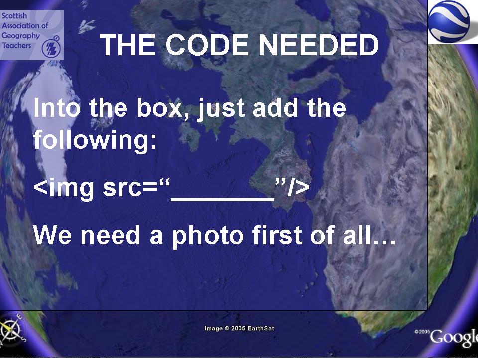
Noel Jenkins and Gavin Richards have both posted examples of how to customise placemarks to add other digital content.

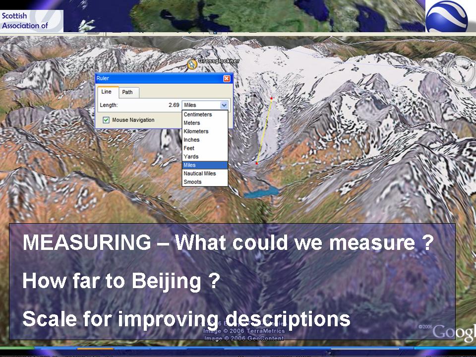
A close up view of the Google Moon, while I took a picture of the audience...


Tuesday, October 31, 2006
SAGT Presentation Slides 108-110


This features Atlas Gloves. These have been used successfully by Noel Jenkins and used at school open evenings.
 Picasa Web Albums are a way of geolocating your images and viewing them in Google Earth. This is something worth investigating.
And try the GENERATOR BLOG for all those quirky generated images, plus of course FLAGRANT DISREGARD's Flickr Tools - another of my Top 10 creative sites...
Subscribe to:
Posts (Atom)