Friday, June 21, 2013

Google Touring

A useful post from Richard Treves outlining a possible solution to the problem with Google Tours that seems to affect people in version 7


Richard was hoping to join me at my Google Earth course, but unfortunately couldn't make it...
Maybe next time :)


Tuesday, June 18, 2013

River Severn


Quick example of building a lesson idea, based on the River Severn.

Search 'River Severn KML '
Uncovers files for the source of the Severn and the Plynlimon catchment. This is where the river starts, before it heads off on its long journey to the sea.

Go to BBC Learning Zone and find a clip on the River Severn from source to sea or explore the Upper course of the river

Has a helicopter shot over the moors near the source - could recreate that in Google Earth as a tour as one 'challenge'.

Put together a set of shots that the helicopter pilot has to film, and recreate those as tours, or find the locations and add them into Google Spreadsheet Maker 2.0 to create placemarks along the route.

What will students discover about the course of the River Severn ? It starts by heading in the opposite direction to the one that it eventually takes ? Can they discover why it changed direction ?

Students to investigate the way that the landscape changes as they move along the route, or explore examples of the ecosystem services that the river provides.

Identifying river features from the air.

Adding in some other land uses and evidence of how people are using the river. How has the river changed by the time it has passed down to the lower course ?
Use the measurement tool to see how the width has changed over that time.
Drag in the Environment Agency website data to see what the usual and current levels of flow are at various points along the river.

Sourcing CC images - perhaps making use of GeoGraph for these
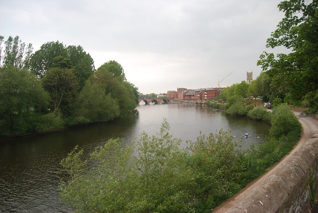
e.g. this image of the Severn near Ribbesford Woods.

Click to get the location of the image - add in the extra figures of the grid reference.
Use NEARBY to convert to lat long

Can also get a lat long if you know where the location is by switching to Google Maps. Right click on a location and select What's Here, or look bottom right in Google Earth to see it displayed.

Can also save images from searches on Geograph - KML files can be generated of groups of images, or those around an area. These could be saved and form the basis for some investigation.
Carry out a SEARCH on GEOGRAPH and look for the KML link at the bottom of the search returns page.


An overview of the River Severn here.

Look for changes to the course using the NPE MAPs link which shows old maps. Has the route altered as a result of management...

What else could be added here ?

Image: Alan Parkinson


Google Spreadsheet Mapper 2.0

A reminder of this tool which adds some additional assistance to the process of mapping data from spreadsheets.
Part of Google Earth Outreach work.

Open up the special spreadsheet, and save a copy in Google Drive.
You can amend the sample contents to suit your project, and publish the spreadsheet.
This will generate what is called a NETWORK LINK.
This means that any changes to the spreadsheet will result in a different map being generated

And also removes the need to have a spreadsheet package installed on your machine...

A video here:


Wednesday, June 12, 2013

Embed KML gadget

Made a KML file - perhaps a TOUR ?

Now you can embed it on a webpage using the EMBED KML GADGET

I made a new GOOGLE SITE to host my files...

https://sites.google.com and follow the instructions...

Copy the Link Address and paste it in...

Tuesday, June 11, 2013

Google Earth and Maps course now OPEN

The Google Earth and Maps course that I mentioned a while back has now gone live...

You can participate in courses for both Google Maps and Google Earth.
Go here for more information and to register.

More details on this YouTube video, introduced by Tina Ornduff, who I met at the Dublin Google event last year.


Once you've registered, you'll find out more about the course, which starts on June the 10th....

Why not join me ?

A few other new websites...

A few other Google Earth / Maps related websites which might be of interest...
The first is the Google Earth Engine.

Posted about this before, but a reminder of the environmental elements which can be accessed from the site.
Google Earth Engine brings together the world's satellite imagery — trillions of scientific measurements dating back almost 40 years — and makes it available online with tools for scientists, independent researchers, and nations to mine this massive warehouse of data to detect changes, map trends and quantify differences on the Earth's surface. Applications include: detecting deforestation, classifying land cover, estimating forest biomass and carbon, and mapping the world’s roadless areas.


Also check out the GeoData portal from Tufts University in the USA.

Plenty of layers which can be accessed using the search function, and then adding them to the cart (which enables a download of the data - often in shapefile format)
The shapefiles could presumably then be opened in ArcGIS Online.

There is a user guide which can be accessed by clicking the tab top right....
Thanks to Keir Clarke for the link to the site....

Tuesday, June 04, 2013

Google Earth Balloon Maker

One of the things that most people want to be able to do is change the nature of balloons attached to placemarks so they can add content and format it appropriately.

The Google Earth Balloon Maker from Mr. Macfadden may be the answer for some teachers. It 'automates' the process of creating balloons a little by adding a WYSIWYG (what you see is what you get) style editor...

Watch the video below to see it in action, then try it for yourself...

KML.... not an airline

As I explain on the GA course, files which are created using Google Earth are generally saved in KML format. This is short for Keyhole Markup Language.
If you are particularly keen to find out more, I have a book about KML which provides plenty of information about the language.
What files are available out there ?

Well, to show what can be found, I did a quick Google search on the term 'kml geography' and came up with some interesting files within a couple of minutes:

- a file released by the US Data.gov website showing radiation levels in and around Fukushima.
(follow the link, and use the search button, and there are over 700 files apparently for download on a range of topics) - US based, but plenty on tornadoes, hydrology, hurricanes etc.
- information about files which have been made available by the Office for National Statistics (as well as shapefiles which can open in ArcGIS Online if they have less than 1000 elements to them)
- teach a bit of RE too ? check out these BIBLE files
- wildfires in your spec (Edexcel 'B' for example) - go HERE and click DATA to download KML files for current fires (depending on the season...)

Don't forget the old KML Factbook as well

USGS Earthquake Page

On the GA course, I show how to access earthquake updates from the USGS.
This page of KML resources would be a useful additional resource for students using Google Earth to explore natural hazards.

Friday, May 31, 2013

TIMELAPSE project...


The Time magazine TIMELAPSE project visualises several areas of change: from the growth of Dubai to glacial retreat.
Excellent stuff...

Thursday, May 30, 2013

Let Osprey...

Thanks to Spin the Globe for the lead to a useful resource which uses Google Earth to explore migration and related issues.
It is based on work done to track the Ospreys who live on Rutland Water.
Check out the Google Earth map that tracks them.

Follow on Twitter too: @SpintheGlobe

Adding local images into Google Earth placemarks... and IPERNITY

While running a Google Earth course last week in Birmingham, I went through how to add an image to a Placemark. The first issue was that FLICKR has recently changed. This means that it is less straight forward than it used to be
On the plus side
One disadvantage of this is that many schools may find FLICKR and other possible places to store images are blocked in some schools.

There are other alternatives: a blog could be used for examples, although once again these may be blocked in some schools.

A website called IPERNITY now has the option to transfer up to 200Mb of photos per month from FLICKR.
Some browser add ons need to be installed for this process to work...
Once they are installed, it's very easy to add in your photos one chunk at a time... I'm currently doing that so that my photos 'live' in three places. Check my photos HERE.

A bigger problem was that the facility to add local images: from a laptop or other location that wasn't online had stopped working. This would be useful in a school environment where files could be created which will work within the classroom, and not require images to be fetched from an online location.
It was a bit embarrassing that it was no longer working though as I was expecting to show it in action.

I delved into various forums and found quite a few work arounds for adding local images which didn't seem to work very well, but then found one which did....
The first step apparently is to ensure that LOCAL images can be used with Google Earth, which is a setting in the OPTIONS.
This is not checked by default, but I think needs to be ticked for local images to be available for placemarks.
A particular folder path is then required to add to the code that is provided for adding an image: a KML tag which looks like this - which basically points Google Earth to the location where it can find the source of the image.
Instructions follow - added to Slideshare - hope they're helpful...

 
Getting local image files to work in google earth from GeoBlogs

By the way, the next Google Earth course is in London in June, but it's fully booked.

They'll be running again in 2013-14.
Watch the GA website for details as they emerge.

Free ArcGIS Online course

After the Google Earth / Google Maps course I described in the last post, there's now a chance to take part in another course, this time based on ArcGIS Online.

Sign up at COURSERA for the course, which starts in July.
Details here...


The past decade has seen an explosion of new mechanisms for understanding and using location information in widely-accessible technologies. This Geospatial Revolution has resulted in the development of consumer GPS tools, interactive web maps, and location-aware mobile devices. These radical advances are making it possible for people from all walks of life to use, collect, and understand spatial information like never before.
 
This course brings together core concepts in cartography, geographic information systems, and spatial thinking with real-world examples to provide the fundamentals necessary to engage with Geography beyond the surface-level. We will explore what makes spatial information special, how spatial data is created, how spatial analysis is conducted, and how to design maps so that they’re effective at telling the stories we wish to share. To gain experience using this knowledge, we will work with the latest mapping and analysis software to explore geographic problems. 

Wednesday, May 29, 2013

Google Maps and Google Earth course

I've just enrolled to take part in a new free course that is being offered by Google.
Introduction to mapping with Google.

You can participate in courses for both Google Maps and Google Earth.
Go here for more information and to register.

More details on this YouTube video, introduced by Tina Ornduff, who I met at the Dublin Google event last year.


Once you've registered, you'll find out more about the course, which starts on June the 10th....

Why not join me ?