I've had a free Google Earth pro license for a while now, but a few tweets and other messages today, and a post on Google Earth Blog reminded me that I hadn't necessarily mentioned it here, or recently, so here goes...
You'll need to get it from HERE, and also make sure that you have a license key, which you can request when installing it...you'll also need to connect it to a specific e-mail address and choose a user name.
There are some extra features in the Pro version compared to the standard one... these used to cost hundreds of dollars to access, although I actually had a Pro version back in 2005-6 thanks to Dennis Reinhardt of Google... at the time I was working on the Earth: a Users Guide project, funded by the RGS-IBG, which became this blog.
If you have a previous version of Google Earth you'll need to delete or uninstall it first.
A project originally funded by the Royal Geographical Society (with IBG) with an Innovative Geography Teaching Grant to develop teaching ideas for using Google Earth in the Geography classroom, expanded to include ArcGIS Online in 2014
Thursday, January 29, 2015
Saturday, January 17, 2015
Tuesday, December 16, 2014
ArcGIS Online 3D Scene Viewer
As part of the recent December update to the software, ArcGIS Online now has a range of new features, which are summarised here.
One of them is the addition of catchment area calculations, and also downstream channel plots.. Tried this out for a local river and it worked well...
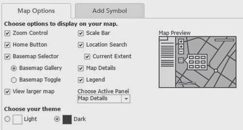
Also extra options for how maps are formatted for embedding on pages, and a new dark canvas basemap, which I like...
Here's a trial map of London
It's interesting timing given the withdrawal of the Google Earth API that one of the most interesting additions is the 3D Scene Viewer option.
Head here to find out more about it... one of my holiday plans is to get stuck into that and see what's possible...
One of them is the addition of catchment area calculations, and also downstream channel plots.. Tried this out for a local river and it worked well...
Also extra options for how maps are formatted for embedding on pages, and a new dark canvas basemap, which I like...
Here's a trial map of London
It's interesting timing given the withdrawal of the Google Earth API that one of the most interesting additions is the 3D Scene Viewer option.
Head here to find out more about it... one of my holiday plans is to get stuck into that and see what's possible...
Thursday, December 11, 2014
ArcGIS Online
A new update to ArcGIS Online has been released, and the details are here.
Some very interesting new features described here.
Here's a 3D resource, for example which shows Volcanoes and Earthquakes.
Looking forward to getting stuck in to this...
Some very interesting new features described here.
Here's a 3D resource, for example which shows Volcanoes and Earthquakes.
Looking forward to getting stuck in to this...
Tuesday, December 09, 2014
Wednesday, December 03, 2014
Sunday, November 23, 2014
Thought for the Day
Gotta keep it simple
Sending out a signal
Everyday is brutal
Now we're being watched by Google
Being watched by Google
Kasabian - 'Eez-eh'
Thursday, October 23, 2014
Open Supermarket Data
Tracking twitter while having a writing day, and in came a tweet about some new data on supermarket locations, at the GeoLytix blog.
This hasn't previously been available as open data rather than commercially provided.
I downloaded it as an XLS and then converted it to CSV and split it into the different supermarket chains so that it can be viewed in ArcGIS Online - locations were using Postcodes for the time being, although other location options are available.
Here's the location of ALDI stories....
And here's a heatmap showing where ASDA stores are found in parts of the north of England...
Plenty of possible options now for exploring this data and looking at retail locations, demographics etc. plus supermarket location activities.
Thanks to @Geolytix for sharing the data
This hasn't previously been available as open data rather than commercially provided.
I downloaded it as an XLS and then converted it to CSV and split it into the different supermarket chains so that it can be viewed in ArcGIS Online - locations were using Postcodes for the time being, although other location options are available.
Here's the location of ALDI stories....
And here's a heatmap showing where ASDA stores are found in parts of the north of England...
Plenty of possible options now for exploring this data and looking at retail locations, demographics etc. plus supermarket location activities.
Thanks to @Geolytix for sharing the data
Labels:
ArcGIS Online,
GeoLytix,
Open Data,
Supermarkets
Wednesday, October 08, 2014
Saturday, October 04, 2014
Sunday, September 14, 2014
Better quality imagery in Google Maps
A Telegraph article describes a new satellite which is providing imagery and this will soon begin to improve the imagery in Google products...
Thursday, September 04, 2014
Geology in Google Earth
More Geology related mapping, this time in Google Earth, via the Google Earth blog.
They are from the MyReading Mapped website, and feature US based examples..
The addition of features such as eskers makes this a useful resource for those studying Glaciation / Fluvioglaciation / Periglaciation at 'A' level...
They are from the MyReading Mapped website, and feature US based examples..
The addition of features such as eskers makes this a useful resource for those studying Glaciation / Fluvioglaciation / Periglaciation at 'A' level...
ArcGIS Online course at Preston Montford
Those who want an introduction to ArcGIS Online should check out this course, being run by the FSC.
DETAILS HERE
DETAILS HERE
Labels:
ArcGIS Online,
CPD,
Field Studies Council,
FSC
Tuesday, August 12, 2014
New RSGS project now live - complete with StoryMaps
In 1844, Hugh Miller: a geologist and preacher (amongst many other skills and abilities) embarked on a voyage through some of the islands of the Hebrides.
I was invited along on the voyage, but will be teaching at the time. I'm going to be involved in other ways. One of them is to produce mapping, such as the Story Map below:
and the map of the voyage:
View larger map
Plenty more to come once the 'Leader' casts off...
He was a self-taught geologist, writer and editor of a key Edinburgh newspaper in the lead up to the tectonic changes in the Scottish church that culminated in the Disruption of 1843. Miller was one of Scotland’s outstanding geologists, one of the first of many Scottish ‘citizen scientists’ and stands beside the greats of Hutton, Lyell and Murchison.
The Cruise of the Betsey took place the year after the Disruption, when 450 ministers broke away from the Established Church. Miller joined his boyhood friend the Rev Swanson, a keen supporter of the Disruption, who had been removed from his Small Isles parish and his manse on Eigg. Swanson used the Betsey as his ‘floating manse’ so that he was still able to serve his parishioners. The cruise was to visit Tobermory, Eigg, Rum, Glenelg and Isle Ornsay on Skye. Miller’s accounts record much about the social circumstances they came across as well as detailed descriptions of the geology, palaeontology and landscapes encountered. During the Cruise of the Betsey, Miller made many ground-breaking scientific discoveries. He wrote about his journey on the Betsey, and other travels through Scotland.
I've been working with colleagues from the Royal Scottish Geographical Society on a website and other elements to accompany a range of teaching materials which will be developed and piloted through the next few months, and the website to support the journey has just gone live.
Here's the background to the project:
Follow our journey, and celebrate the life and achievements of a great Scot, a great scientist and a remarkable observer of the social history of the time. Hugh Miller, of Cromarty, recorded his voyage of discovery on the Betsey, around the Inner Hebrides, in the summer of 1844. Our journey will recreate this 170 years later with a crew of geologists, writers, musicians, geographers and other talented people. Join us on our journey!
6th – 12th September 2014
and the map of the voyage:
View larger map
Plenty more to come once the 'Leader' casts off...
Subscribe to:
Posts (Atom)