Why not share your ideas, and move towards being a COLLABORATOR rather than an ISOLATOR.
Thanks to Quentin d'Souza for allowing use of his image below. Which one most describes your practice and what can you do to move to the left ?

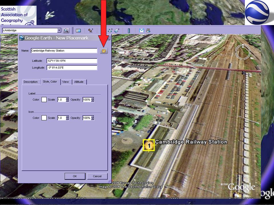
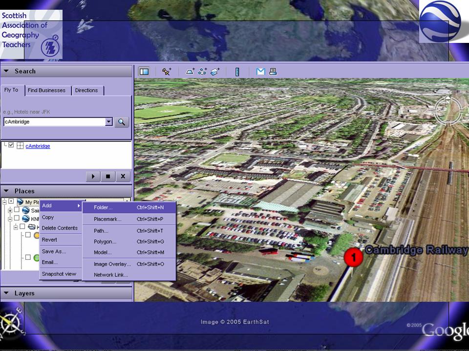
 This will come in useful for us, as we take our 6th formers to Cambridge for a Human field day, and this will make our Virtual walk through even more lifelike. We use Google Earth for fieldtrip briefings.
 Students are asked to find an image which looks particularly impressive artistically, perhaps like the one above, and save it - by screenshotting, or otherwise..
 Enjoying my Space Navigator - it's responsive and I'm getting the hang of the various axes of movement that are available. I love the ability to zoom right into details on images as well, which works very well on the IWB. Get one for Christmas! You can order one from 3D Connexion, delivery is very prompt.
 Discovered this place today while flying around Google Earth with my Space Navigator.
Google Earth just been used by Sky News to zoom in to the location of a breaking news story.

 Head over to 3DConnexion to find out more about the mysterious object pictured above, or read Noel's post at DIGITAL GEOGRAPHY.
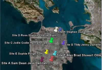

 The USGS have a Virtual Helicopter Ride along the Hayward fault using GE. Go HERE for the details and to download the Google Earth file. An interesting way of exploring tectonic processes.

Maplecroft has launched a series of Google Earth files to complement its Global Maps series. These analyse a wide range of environmental, social, economic and political issues that impact on business and society around the world. With the extremely popular Google Earth 3D viewer, it is now possible to view Maplecroft risk data on an interactive globe, overlay it with other live sources of information, straight from your desktop."


 And finally for this post, over on Juicy Geography, Noel Jenkins has now added FLASH TUTORIALS to his San Francisco Google Earth resource looking at earthquake susceptibility. This is a fine resource. Please support Noel and his work!


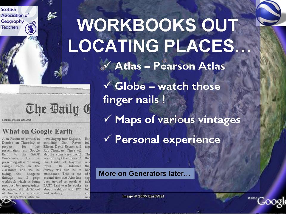 The Workbooks referred to are available to download by going to GEOGRAPHYPAGES. They are available in Word and PDF format.
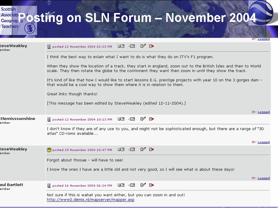

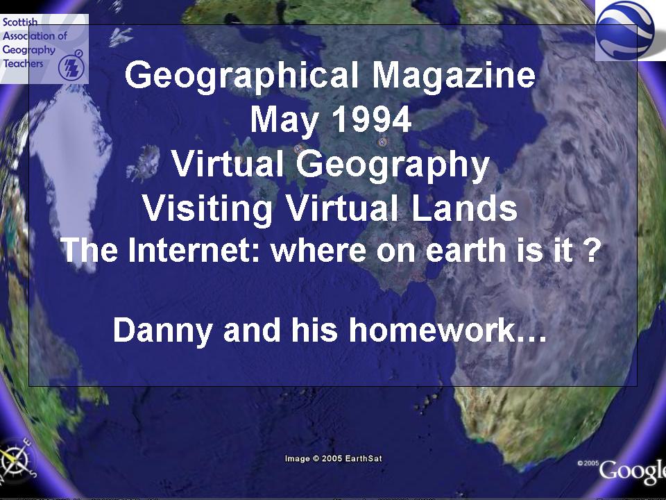
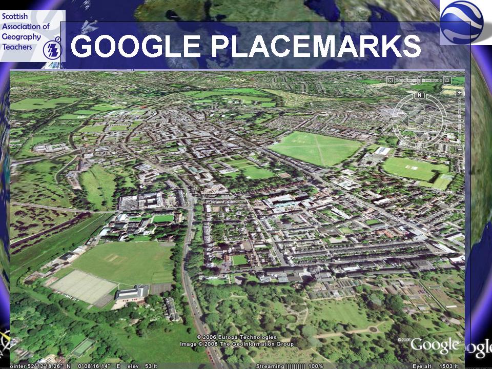
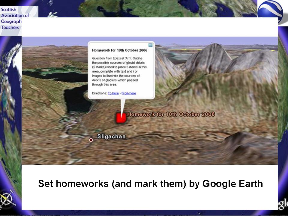
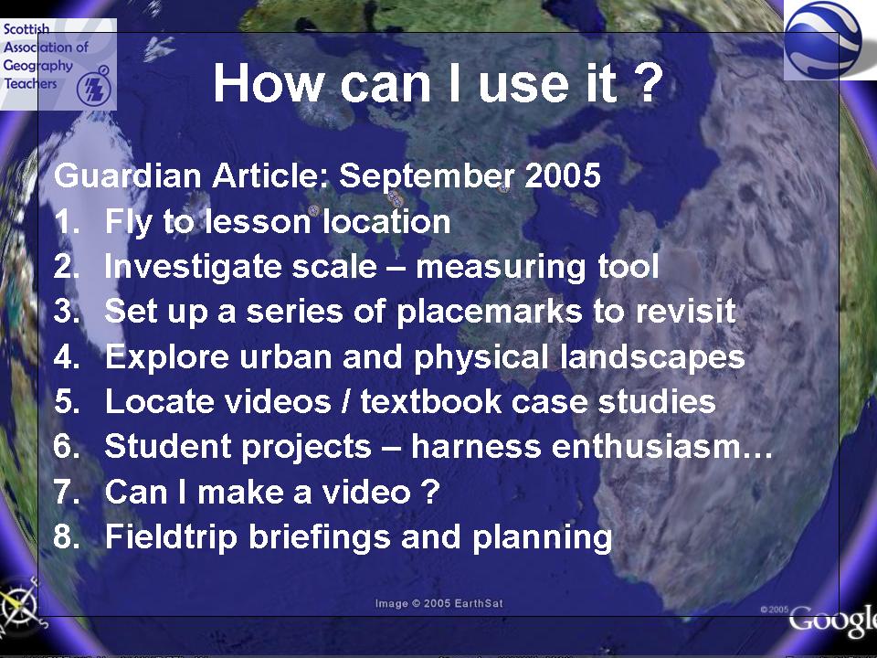 I had an article featured in The Guardian's Brainstrust section explaining how I used placemarks to fly students to the location of the lesson.
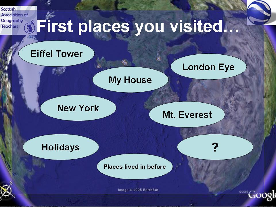 Where were the first places you visited ??


 The image of bicycles is hosted on Flickr. Had a comment posted on it, which said that someone had had their bike stolen from that particular bikeshed.


 Recommend you get yourself a weblog.
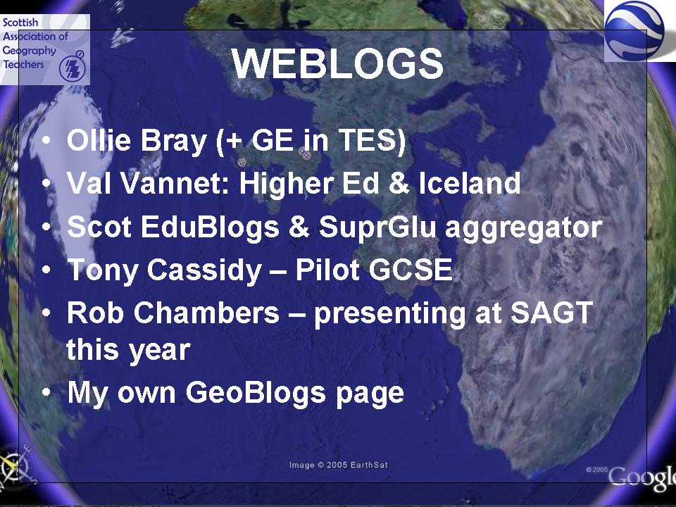